You are using an out of date browser. It may not display this or other websites correctly.
You should upgrade or use an alternative browser.
You should upgrade or use an alternative browser.
The HEART Development and Core Thread
- Thread starter JG Online
- Start date
-
- Tags
- basemap blank maps cartography maps
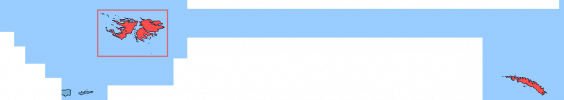
Hi, this looks quite qood. Since you are working at a very southern part of the map, with a lot of projection distortion, I would advise you to compare your work with some images (i.e. Google Maps satellite) to check if all the details are included correctly.I made a patch for the Falkland Islands and the tip of Tierra del Fuego.
This is the very first time I make a contribution in these type of projects, did I do a good job?
Here is an update on your patch, which also includes a few more little islands and lakes.
Are you planning to contribute more to the map? Which areas do you have in mind?
Awesome to see more ppl ware willing to help out with HEART, though I understand it can be a bit confusing for new members to know where they can join in, so me and Tomoto have composed a google docs outlining all the progress on HEART with focus on what still must be added.
But also placing emphasis on features on the map that need a rework/double check. Both Asia and Europe are completly drawn now so it would be especially helpful if ppl could help out with the Redo's and Double check features so me and Tomoto can focus on finishing the rest of the map. Of course making historical patches is great too, I think a 1914 HEART map would be useful to alot of ppl here?
We will try to keep it updated but our main focus will be making new patches so if its ever not up to date just call it out here")
But also placing emphasis on features on the map that need a rework/double check. Both Asia and Europe are completly drawn now so it would be especially helpful if ppl could help out with the Redo's and Double check features so me and Tomoto can focus on finishing the rest of the map. Of course making historical patches is great too, I think a 1914 HEART map would be useful to alot of ppl here?
We will try to keep it updated but our main focus will be making new patches so if its ever not up to date just call it out here
Last edited:
I would like to help in South America, but I don't have a lot of time at my disposal, maybe I could do some small areas and islandsHi, this looks quite qood. Since you are working at a very southern part of the map, with a lot of projection distortion, I would advise you to compare your work with some images (i.e. Google Maps satellite) to check if all the details are included correctly.
Here is an update on your patch, which also includes a few more little islands and lakes.
View attachment 898398
Are you planning to contribute more to the map? Which areas do you have in mind?
What would you think about trying some more of the Caribbean Islands?I would like to help in South America, but I don't have a lot of time at my disposal, maybe I could do some small areas and islands
Maybe, but still no guarantee, maybe I could do work in weekendsWhat would you think about trying some more of the Caribbean Islands?
That is what I am working on currently. You can see on the progress map (the latest version is posted here) which areas are already being done.What would you think about trying some more of the Caribbean Islands?
If you only have time for some smaller contributions, you could also consider doing the 2nd levels for some countries. There are a lot that do not have them yet.Maybe, but still no guarantee, maybe I could do work in weekends
Patch #78
Thankfully America seems to be getting more arid going southwards into New England already but some of the straight lines that form the country borders are suprisingly tricky to draw due to the distorition, still the coastline is quite complicated, but I managed to finish another 5 states and expanded a bit further into Canada as well.
Added New Hampshire
Added Vermont
Added Massachusetts
Added Rhode Island
Added Connecticut
Added Isle de la Madeleine
Little vent about how terribly inaccurate many areas of Canada are on M-BAM, currently working on the area around Montreal but this is just terrible on M-BAM

Not exactly sure what they were thinking when drawing this as it barely even looks like Montreal, which is not 1 but 3 islands surrounded by a river not even a quarter as broad as depicted here, and the St. Lawrence river just ends there while in reality it gets actually wider closing to the US border???
Hope the person who drew M-BAM Canada isn't reading this thread but this is easily the worst quality area of M-BAM considering how many ppl ought to live near it 💀
I think I previously explained this but HEART does not have an established colour scheme, mostly I am picking colours as I go for the basemaps clarity, but you are free to use whatever colours suite you and you wouldn't be misusing HEART just as you wouldn't a M-BAM or Q-BAM mapWhat's the color of imperial Russia, Austria-Hungary and Ottoman Empire in HEART?
Perhaps I can develop a fully fledge HEART colour scheme if enough ppl think it would be convinient but this is probably something I am unlikely to touch untill at least the entire basemap is finished.
I would use the DCS colours if in doubt.What's the color of imperial Russia, Austria-Hungary and Ottoman Empire in HEART?
I'm sorry to be annoying but I had reserved this region. I finally had time to figure out the Q-gis process just a few days ago so I'm disappointed to find that you just beat me to it. I don't know if you saw my post in late February:Patch #78
Thankfully America seems to be getting more arid going southwards into New England already but some of the straight lines that form the country borders are suprisingly tricky to draw due to the distorition, still the coastline is quite complicated, but I managed to finish another 5 states and expanded a bit further into Canada as well.
Added New Hampshire
Added Vermont
Added Massachusetts
Added Rhode Island
Added Connecticut
Added Isle de la Madeleine
View attachment 898591
This update means all of the USA is done, right? If so then I guess I unfortunately won't be contributing as I don't feel familiar enough with other areas.I do intend to come back to this at some point, I've just been busy with other projects and I was sick for about 10 days this month. I'll let you guys know if I'm definitely not doing the parts I said I would so other people can finish them.
Last edited:
Not at all annoying, I honestly just forgot in my excitement to start on the US because its been a few months that you said you were going to do it, I am sorryI'm sorry to be annoying but I had reserved this region. I finally had time to figure out the Q-gis process just a few days ago so I'm disappointed to find that you just beat me to it. I don't know if you saw my post in late February:
This update means all of the USA is done, right? If so then I guess I unfortunately won't be contributing as I don't feel familiar enough with other areas.
No, Except for Hawai and Puorto Rico, the rest of the US and Canada still needs to be done if you want to claim any areasThis update means all of the USA is done, right? If so then I guess I unfortunately won't be contributing as I don't feel familiar enough with other areas.
Patch #79
Added Zimbabwe
Added Mozambique (Credit to Tomoto for the reefs)
Added Malawi
Added Zambia
Added New York
Added Lower Quebec
Added Anticosti Island
Yeah, I remember that, I'm asking because I think you can just in moment choose the color of those empiresI think I previously explained this but HEART does not have an established colour scheme
That is fair, though for now creating a HEART colour scheme isn't one of my priorities, and a countries colour can easily be changed later with a single click of the fill bucketYeah, I remember that, I'm asking because I think you can just in moment choose the color of those empires
As @Pragmatic Progressive said you are probably good by using DCS for now, since it is literally so easy to change later

I'll claim the states in red:No, Except for Hawai and Puorto Rico, the rest of the US and Canada still needs to be done if you want to claim any areas
Last edited:
This doesn't really work as I have already finished New Jersey, Pensylvania, Delaware and Maryland, I will leave the other reds to you though as I was planning to follow the coastline south for the time being, so you could still do merenlandI'll claim the states in red:
Share: