Lands of Bronze and Fire - An American Domestication Timeline, Take Two

I. Lands of Bronze and Fire, the Uurung, and the First Cradle
  • Huehuecoyotl

    Monthly Donor
    A scene of a juniper scrubland in New Mexico. It appears to be early morning or late evening in the picture.


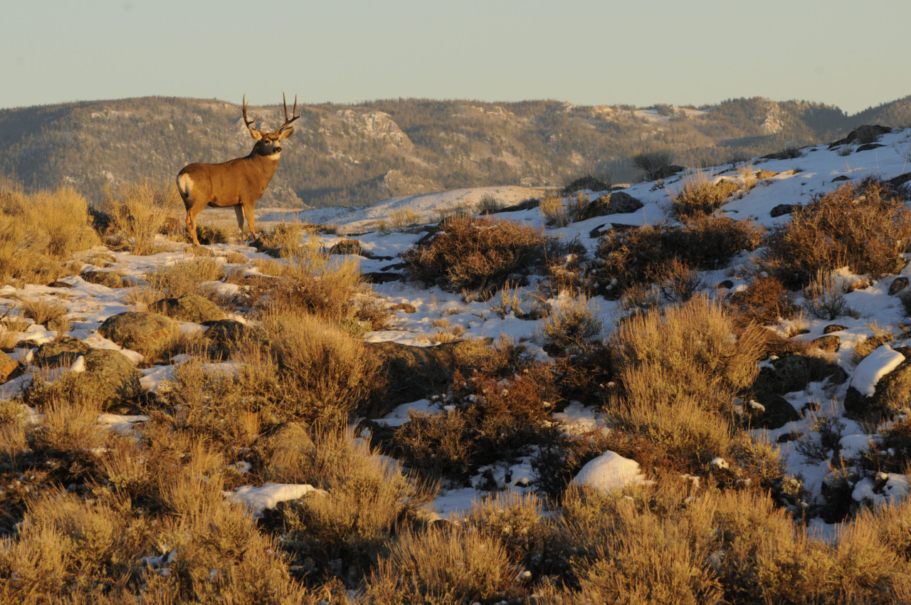
    Northern *New Mexico, ca. 10,500 BCE

    The chorus of whistling birds filled the early morning with joyous sound, masking the footfalls of the hunter as he trod gingerly through the scrub grasses. Out into the scrubland he had dashed, following the familiar traces until he'd come nearly within sniffing distance - then he crept, step by step. Careful now... With a hand he carefully parted the bushes, and was rewarded for his efforts with, at last, a glance at his elusive quarry.

    The beast was tall and ungainly-looking - he wondered if perhaps its kind had been deer until stretched out by the hands of the creator. Atop a long neck sat a grossly large head, the beast’s dark, beady eyes turned away from the human as it browsed among the fresh shoots of a low-lying tree. Fat, padded feet, hard nails on the tips, mashed the rather less interesting grasses underfoot, a small tail flicking at the flies accompanying the creature.

    Even in his father’s time, these long-deer had been common in the Lands of the Juniper, but increasingly their numbers dwindled, drawing away to the highlands of the great mountains and the distant south. The hunter considered it an omen of great fortune that an animal bearing so much good meat had wandered into his hunting grounds. Licking his lips and squinting against the light of the rising sun, he readied his atlatl – and let fly.

    The crude spear sailed through the air, and here something changed. Perhaps the sunlight had worsened the hunter’s aim by a hair. Perhaps the long-deer’s eyes turned to a different leaf or shoot. Perhaps a slight twitch of the hand or an unnoticeable buffet of the air had altered the spear’s course. Whatever tiny alteration had taken place, the spear narrowly missed the animal.

    The weapon crashed through the thickets past the heretofore-browsing long-deer, creating a great racket and spooking the animal. With a terrified bleat, it wheeled, charging off into the juniper forest, and was gone.

    Smacking his forehead and cursing his stupidity, the hunter went to retrieve his spear, deciding that the elusive long-deer was not a lucky omen after all.

    And so, a single animal, who in our own timeline would have perished at the spear’s point, escaped to the company of his fellows in the nearby highlands. The young male’s genes passed into the gene pool of this previously-dwindling species of North American camelid, affecting the population just enough within a few short generations to pass on his speed and hardiness to his progeny.

    Hemiauchenia macrocephala survived by a hair, and the world would be changed forever.


    A Camelid Odyssey
    40 Million Years of Evolution


    A cladogram of camelids. Hemiauchenia macrocephala is seen branching away from camels as the presumptive ancestor of llamas and guanacos.

    A family tree of the living members of the family Camelidae. Hemiauchenia macrocephala, which is extinct in our timeline, is placed on the tree in red above its probable descendants, today's South American camelids.

    The camelid family is a remarkable group of animals. Belonging to the order Artiodactyla (that is, the even-toed ungulates), Camelidae is the sole surviving representative of the suborder Tylopoda. Though today its only relations are (very distantly) pigs, and ruminants like cattle and deer, the tylopods once bore a diversity of forms such as the anoplotheres and the somewhat less obscure oreodonts. All we have in our own timeline today to attest to this once-great diversity are the six extant species of camelids which represent this unique clade of hooved mammals.

    Camelids are distinguished by their long necks and legs, their unique dentition (their canines and premolars are almost like tusks), and their lack of hooves - modern camelids all have padded feet with a pair of toenails (thus Tylopoda, 'padded feet'). Camelids by and large are found in arid environments of any temperature, from Andean mountains and deserts to the cold steppes of Central Asia. In the past, fossil camelids even thrived as far north as the Arctic Circle, proving the hardiness of this family and its adaptability to many different climates. The earliest known representative of Camelidae is the tiny, deer-like Protylopus, which lived in the Eocene, 45 million years ago. While Protylopus had four toes rather than two, and appears to have had hooves on its feet (unlike any living camelid), otherwise it already exemplifies the basic, camelid body plan.


    Protylopus. It's an extinct camelid sort of resembling a small llama or guanaco.

    Protylopus petersoni

    The camelids carried on in modest success, diversifying in form and occupying most of the large mammal browsing niches of North America, but never spreading outside of the continent. Nonetheless, from California to Tennessee and from Canada to Mexico, the camelids spread across the continent, and persisted through every epoch of the Cenozoic Era from the Eocene onward. The camelids would have their heyday during the Pliocene when North America and South America met at Panama for the first time since the age of the dinosaurs. This momentous event has been termed the Great American Interchange, and began around 3 million years ago. Large mammal species (and large birds in at least one case) migrated over the new land bridge, seeing the introduction of armadillos, ground sloths, and saber-toothed cats amongst others to North America, and the horse, elephant, tapir, and (most importantly to our purposes) camelids, to South America. At about the same time, the camel branch of the family crossed over into Eurasia for the first time via the Bering Land Bridge in Alaska, soon siring the lineages that would become today's dromedary and Bactrian camels.

    A tilted map projection with the arctic centered and the Americas horizontal. Lines show the migration of camelids across the Bering Land Bridge to Afro-Eurasia.


    The dot in western North America represents the area in which the camelids originated.

    It was only when the growing human diaspora invaded the continent in the last 30,000 years that their ongoing success was threatened - by the end of the last glaciation, the camelids of North America were very nearly extinct, soon to be relegated to the same fate as their oreodont and anoplothere cousins before them.

    But perhaps, if a hunter had missed his target...


    The Uurung
    Hemiauchenia macrocephala, the Quintessential Columbian Camelid
    From "The Uurung, A Natural History" by Addison Shorely, Oxford Press


    An illustration of Hemiauchenia macrocephala in its wild form. It resembles a llama with a sturdier body and a boxier head.

    Hemiauchenia macrocephala in its wild form (compare with this image of the South American llama.)

    Evolutionary History

    Consider, for a moment, Hemiauchenia macrocephala, the taxon from which all modern Hesperidian [American][1] camelids are descended. It's hard to imagine Columbia [North America] without its teeming herds of domesticated uurung, but it could very easily have not been the case. Genetic evidence shows that the Columbian population of the genus passed through a dangerous genetic bottleneck about 12,500 years ago, and that there may have been as few as only a few hundred Hemiauchenia across the whole of that vast continent.

    Just what rescued Hemiauchenia from the same fate that befell their cousin, Camelops, is unknown, as the same extinction event claimed almost all the megafauna of the continent at the end of the last Ice Age. It seems to have been a happy accident that this remarkable animal rebounded following this nadir, giving rise to the splendid variety of Columbian breeds we see today.


    An illustration of the extinct Camelops. It resembles a large Dromedary camel.

    Camelops hesternus, the Columbian camel.

    The genus, once it recovered, branched out rapidly, claiming the niches left behind by the extinct Columbian horses and bison[2]. They would soon make the jump across the desert to highland Isthmocolumbia [Meso- and Central America] and north along the length of the Alinta [Rocky] Mountains. From here the species diverged into two distinct wild subspecies: in Isthmocolumbia, the larger and more robust paixaay (H. m. macrocephala) arose, and in Petsiroò [a country in the *American Southwest], the smaller and more gracile breed traditionally called simply the uurung (H. m. petsiroensis) arose. As the name of the latter came to be used as a general term for all wild and feral members of Hemiauchenia, the Petsiroan variety has come to be instead called the true or Petsiroan uurung.

    Description

    Although the two subspecies of wild uurung share a number of differences in appearance, it is plain to see that they are both members of the same species. Both, like all camelids, have slender necks, long legs, and padded feet. As with all living lamines, the uurung are smaller than any Eurasian camels, but stand much taller than their Madeiran [South American] fellows. The wild male paixaay stands between 7.7 and 8.2 feet (2.34 - 2.50 meters) at the crown of its head (females are a head shorter), and even the comparatively smaller true uurung stands at between 6.5 and 7.1 feet. (1.98 - 2.16 meters). The former weighs in at an average of 670 lbs (304 kg), the latter a scant 510 lbs (231 kg).

    Uurung have proportionately longer legs and larger heads than the Madeiran glama [the llama]. These strange proportions, like those of some African antelopes, allow both varieties of uurung to rear up onto their hind legs for a time to reach higher vegetation. In terms of dietary habits, uurung of both kinds have broad tastes in vegetation, owing to their far reach and well-varied dentition. These allow the animals to browse or graze as the situation demands. Uurung will prefer low-lying leaves and shoots, and abrasive grasses, if given the choice.

    Uurung pelage resembles that of most other camelids in texture, providing soft, lanolin-free wool when grown to the right length and shorn. Paixaay fur is short, a signature of its adaptations to arid, semi-tropical savanna and desert, while the coats of true uurung are longer and shaggier. Paixaay fur ranges in color from a dark brown to a sandy, almost blond tan, while true uurungs come in brown, white, black, and any shade or combination thereof.

    Unlike most other mammals, but as is the case with all camelids, uurung are induced ovulators, and their females do not experience heat or estrus every year. Almost without exception, the dam will give birth to a single cria [juvenile lamine], and will care for the young uurung for a year or two, when the juvenile reaches sexual maturity. A paixaay cria weighs around 56 lbs (25.4 kg) at birth, and that of a true uurung about 43 lbs (19.5 kg).

    Uurung of all varieties are social animals. A group of paixaay will range anywhere from a single breeding pair up to a herd of over 20 animals, and true uurung herds can grow even larger. It is a rare occurrence to find an uurung of either type solitary. There is a strict pecking order within the uurung herd, with a single dominant male or breeding pair leading a number of females.

    The social lifestyle, wide dietary range, and great adaptability of the camelids have seen their domestication in every continent on which they are found. In Columbia, it would see its domestication on two separate occasions.


    Domestication

    Since its survival by a hair's breadth at the close of the Pleistocene, the uurung's population had been slowly recovering, and by 5500 BCE had recovered to the levels of the Ice Age. Certainly human hunting of the animals had continued in this period, but it was only at this time that human societies began to take a serious interest in harvesting uurung meat.

    Even fairly early in the Archaic Period, the wild true uurung (Hemiauchenia macrocephala petsiroensis) was prized for both its meat and its wool. Its fluffy pelage, while not yet as long or as thick as that of some of its domesticated descendants or its cousin the alpaca, was still useful to the people of the mountains and the foothills of the Alinta Mountains. Even in the lowlands and deserts, so hot during the day, the nights at certain times of year could be fairly cold. It was common practice, every two years or so, to drive herds of the animals into funnel-shaped corrals or mountain gorges, cut off their fur, and then set them free to be shorn again another day.

    To a lesser extent, hunters sought out the preferred grazing places of the uurung, taking care to slaughter only as many as they needed to eat, and leaving the rest to keep the population growing. By 4000 BCE, semi-nomadic settlements had gained the habit of settling down near these areas of high uurung population density, and soon it became common practice to capture and tame crias to be raised close to home, ultimately to be slaughtered once they reached adulthood. Another 500 years or so passed until entire small herds were being tamed in this fashion, and true domestication of the uurung began in earnest.

    It is thus around 3500 BCE that the uurung was domesticated in Columbia for the first time, roughly in the same period as the camel in Arabia and the glama in Madeira. In the chilly mountains and foothills of the Duuye [Colorado Plateau], human settlements blossomed into a new period of growth as corrals of domesticated uurung sprung up all around the highlands. Due in part to the climate, which was hospitable for the animals, and due to the displacement of hunter-gatherer groups by the increasingly more populous uurung-herders, the range of uurung domestication spread rapidly up the length of the Alinta Mountains. By 2200 BCE, domesticated uurung were grazing near the shores of the Great Bitter Lake [Great Salt Lake], and by 1400 BCE had reached the Tuuwayan deserts[3] and the eastern end of the Nehwian Mountains [Sierra Nevada].

    Interestingly enough, a fluke of ecology would give the first uurung-herders of Petsiroò an unexpected tag-along.

    Part of the population growth of the uurung after the end of the Ice Age was owed to the extinction of almost all of the large carnivores that preyed on the uurung, such as the American lion and Smilodon. Although crias could still fall victim to surprise attacks from mountain lions, jaguars[4], or wolves, adult uurung no longer had any natural enemies. Most Columbian predators soon learned to avoid uurung herds, as an angered adult uurung is fully capable of killing even the most persistent of carnivores, owing to its considerable size.

    Another large ungulate was found in the true uurung's range - the bighorn sheep, Ovis canadiensis canadiensis. Although not terribly flighty, and somewhat social animals, bighorn sheep (who share the same genus as the mouflon, the ancestor of the Eurasian sheep) have a fairly poorly-crystallized social hierarchy. Every mating season, competing males assert their dominance in their famous head-butting matches, but there is no such thing in a bighorn herd as a dominant male. If it weren't for the species' unique relationship with the uurung, this obstacle may very well have prevented the domestication of the sheep in Columbia.

    While sporting a formidable rack of horns, the bighorn sheep is small enough not to enjoy the same lack of serious predators as the uurung. Bighorn lambs are especially vulnerable, but even adult rams aren't entirely immune. Bighorn sheep herds have since learned to stick near uurung herds, often intermingling directly during the wetter seasons when food is at its most plentiful. Thus, when domesticated herds of uurung began to make their home in or near human settlements, the sheep, who had begun to treat the camelids almost as leaders of the herd, followed after them.

    By 1400 BCE, the Columbian sheep joined the uurung as the second large, mammalian domesticate of Columbia, and the third (or fourth) of Hesperidia.

    Past the Tuuwaya Desert again, domestication came more slowly. The need to harvest uurung meat didn't arise as early as it did in Petsiroò, as Nuuyoo [Mexico in the Mesoamerican sense - that is, sans Yucatan] had a well-established set of crops which fed its population with general reliability. In fact, it was these crops that would ultimately lead to the independent domestication of the uurung in Nuuyoo, as the abundant new plant matter in the fields of the region proved appealing to juvenile paixaay. Although initially it was more common simply to kill the intrusive uurung for their meat, later on a process of capturing and taming similar to that in Petsiroò would catch on. By around 3000 BCE, a half of a millennium after the true uurung, the paixaay joined its cousin among the ranks of Columbian domesticates.

    Domestication of the paixaay spread more slowly, but by 1400 BCE, it had spread into all but the most humid areas of Nuuyoo, and was expanding in the direction of the Tuuwaya. Here, as trade routes converged and the two breeds of uurung met, the future of Hemiauchenia and Columbian society would change forever...


    A map illustrating the spread of the two earliest breeds of uurung - the true uurung and paixaay. The true uurung spreads from the Colorado plateau across much of the western USA. The paixaay spreads from the isthmus of Tehuantepec north and west into greater Mexico.

    The spread of the twin breeds of domesticated uurung, as of 1400 BCE at the beginning of the Great Columbian Synthesis.


    Lands of Bronze and Fire
    An American Domestication Timeline


    --------------------------------------------------------------------

    [1] - Rather than being identified as a true pair of continents (e.g., "The Americas" or "America") ITTL, they can be grouped instead as Hesperidia, the lands of the Western Hemisphere. This is largely synonymous with the "New World".
    [2] - By the time of European contact, the American bison will have gone the way of its big-horned, Ice Age cousins and be driven to extinction, displaced from its grazing lands by vast uurung herds. It's Eurasian cousin, the wisent, will survive it - but whether it survives to the present itself remains to be seen.
    [3] - This is a slightly nuanced term. It refers collectively to the Sonoran, Chihuahan, and other north Mexican deserts, as well as any non-desertine areas which happen to fall between Oasis- and Mesoamerica. Tuuwaya will be very important later on.
    [4] - Owing to the survival of the uurung (and a couple other megafauna species whom we will meet later), the jaguar enjoys a much larger range in western North America. The California condor will likewise enjoy better luck ITTL.

    I don't want to rehash stuff which others have already written on extensively, or to busy myself with things hardly affected by the POD, so here's some "out-of-class" reading for you:

    http://en.wikipedia.org/wiki/Agriculture_in_Mesoamerica
    http://en.wikipedia.org/wiki/Peopling_of_the_Americas

    Neither of these should be significantly different ITTL


    The First Cradle
    The Formative Period in Naizaa
    From "Two Cradles: New Revelations of the Origins of Civilization in Columbia" by Otis van Hoek, Nova Vizcaya University Press, 2006

    A satellite image of the Isthmus of Tehuantepec.

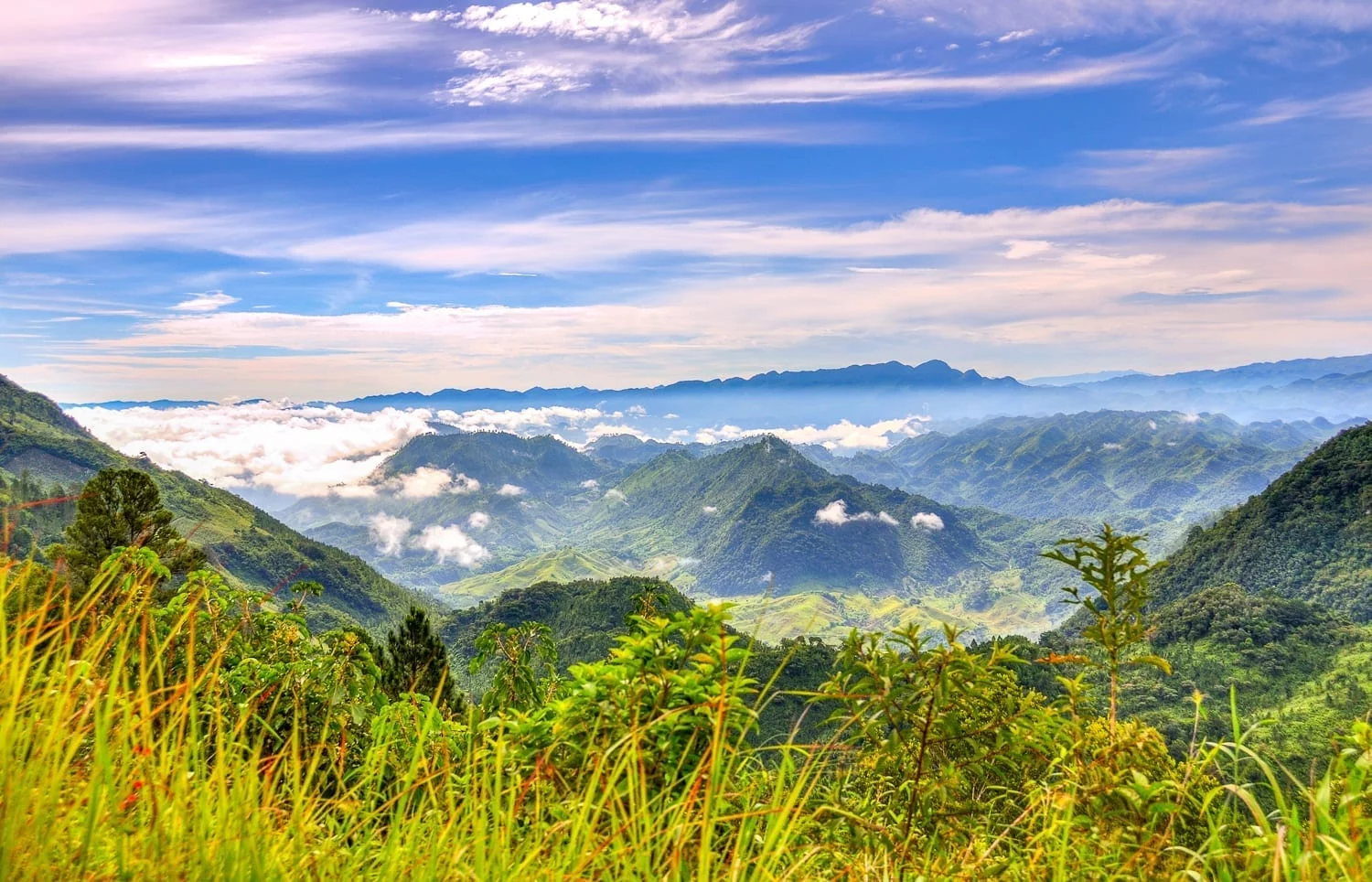
    Anthropologists have often opined that it is in areas of great climatic variation that complex cultures first develop, and the region of Naizaa would seem to lend this idea credence. A thin but mountainous strip of land separating the Atlantic and Panthalassic [Pacific] Oceans, the Isthmus of Naizaa bears a staggering number of microclimates amongst its misty mountains. Shaded valleys knock elbows with the Gulf coast's humid jungles, while the Panthalassic coast tends to be cooler and more arid. Highland plateaus and the trailing end of the Nava [Sierra Madre] ranges dominate much of the landscape, interrupted by the narrowest point of the Isthmus itself. Here, trade winds blow from the Gulf to the Panthalassic, spawning disastrous mountain-gap winds, with hurricane-like effects on the region. Despite the often unstable climate, it was here that Columbia would, for the first time, attain three monumental accomplishments - the development of agriculture, the domestication of large mammals, and the birth of civilizations.

    It was not, however, in those mountains, but in the humid lowlands along the Gulf coast that the continent's first city would be born. First uncovered in 1961, the original name of the ancient city (settled perhaps around 1750 BCE) is long since lost. Now it bears a name from the language of the later Otopa - "Manaj Babil". Though today only the faded outlines of foundations and an earthen mound give any indication that Manaj Babil ever existed, decades of study will ensure that it will be forever remembered as the oldest city of the continent - at least until an older one emerges from the jungles to claim its lofty title. Despite its recent archaeological importance, the site is threatened by encroaching urban development, a symptom of the endemic obstacle presented by growing human populations to the study of Nuuyoo's ancient past.

    A few middens on the perimeter of the site show that precious jade and chalcedony from the distant highlands of Qu'umark [Guatemala] were rare and popular commodities at Manaj Babil, hinting at the distant and complex trade relations which already were springing up throughout the region. This and the site's stone buildings show that Manaj Babil likely had a political elite, capable of organizing civic projects, and forming networks of trade. For better or for worse, social stratification was born. Here there were not yet any large, domesticated mammals (save for man's eternal companion, the dog), and though game such as deer and moco [turkey] must have made up a significant portion of the diet, analysis of preserved containers among the ruins shows that maize, beans, and squash made up the bulk of it.

    In spite of its surely eternal importance to Columbian archaeology, Manaj Babil itself seems only to have been occupied for about a century or two before being abandoned, perhaps choked out by growing jungles or outcompeted by the first centres of the Otopa culture[1] growing further to the east.

    For centuries imagined as one of two sisters from which all Columbian civilization arose, like some sort of latter-day Babylonia, the mythical role of the Otopa as a mother culture has since faded as the importance of Manaj Babil and other early sites came to light. Nonetheless, a great many cultural innovations passed on to later Isthmocolumbia (and of course elsewhere later on) were pioneered in the ancestral Otopa lowlands. Where no writing exists from Manaj Babil or other Archaic sites, when the central Otopa site at Oote Nanav[2] arose with the dawn of the Formative Period its walls almost immediately began to speak. This early Otopa script has yet to be deciphered in any meaningful way, but would seem to represent the point from which written language would be transmitted to later societies of the continent. Likewise, numerous artistic-devotional themes (the jaguar, the feathered serpent, etc.) can first be found carved into the walls of Oote Nanav's temples.

    The site appears to first have been occupied by 1600 BCE, the first middens of pottery from the farming communities there forming most of the original layers of archaeological finds. Stingray barbs and conch shells are also common, owing to the site's closeness to the coast. The city grew quickly, and by 1500 BCE, when other Otopan cities were coming into their own throughout the Isthmus' lowlands, the site was dominated by pyramids and temples, as well as the domed Observatory on the acropolis. We mustn't be fooled by 17th-century imaginings of the ancient Otopa as peaceable astronomers, despite the detailed diagrams of the movement of the planets that they left behind in their observatories. As other Otopa centers sprung up in the surrounding region, conflict surely erupted at times over territory and resources - at least one site, south of Oote Nanav, seems to have been destroyed violently by fire.

    As the early Otopa culture reached its florescence, the highlands southwest of Oote Nanav where maize was first mastered experienced the rise of their own complex societies. The uurung, which fared so poorly in Otopa lands, flourished here in the highlands and on the drier, Panthalassic side of the Isthmus. This country, since dubbed the Nivdavaya after the people who live there, thus was soon home to its own cities, sprouting up among the fertile valleys; by 1500 BCE, the first Nivdavay civilization was born.[3] Individual towns and cities occupied their own hills or valleys, supported by terraced farms and great paddocks of uurung, generally remaining independantly-minded and separate from one another politically. This aloofness and sense of individuality, some would allege, has remained a distinguishing feature of the Nivdavay all the way up to the present, but soon one town would gain primacy and promise an end to this first, greatly fragmented period in their history.

    In a valley among the Nava peaks[4], the city of Tsung'oo, today the longest continuously-occupied city of Hesperidia, rose around 1460 BCE. Owing to its commanding position, central location, and fine farming land, Tsung'oo quickly grew to dominate the region, establishing vassalship over many of the smaller Nivdavay sites. Interaction between the Nivdavay and Otopa was frequent, and often violent. The population of the Nivdavaya tended to grow more quickly than that of the lowlands, probably owing to the plentiful meat harvested from the domesticated uurung of the highlands. Even as Otopa culture enjoyed its height in the early 15th Century BCE, sites near the foothills were being encroached upon by Nivdavay herders and warbands. By the time that Oote Nanav and the other major sites realized that they were being edged out, it was probably too late to tip the scales against the Nivdavay advance...


    --------------------------------------------------------------------

    [1] - A Mixe-Zoquean people; OTL's Mokaya, Olmec, or possibly both.
    [2] - On the Coatzacoalcos, near the foothills of the Tuxtla mountains; near San Lorenzo Tenochtitlan.
    [3] - The Nivdavay are none other than the Mixtecs.
    [4] - The Valley of Oaxaca, to be exact.

    A few more differences from the last time around - as well as a different and more logical order to these early updates. Any thoughts or comments so far?
     
    Last edited:
    II. The Second Cradle
  • Huehuecoyotl

    Monthly Donor
    The Second Cradle
    The Formative Period in Petsiroò
    From "Two Cradles: New Revelations of the Origins of Civilization in Columbia" by Otis van Hoek, Nova Vizcaya University Press, 2006

    A satellite image of the southwestern United States.

    The landscapes of Petsiroò seem almost otherworldly when compared with those of Nuuyoo. It is a land of tall evergreens, red bluffs, and goliath canyons which score the surface of the dry land like scars of battles waged deep in geological time. Though undeniably beautiful, its agricultural prospects seem somewhat lesser than those of Nuuyoo's fertile valleys. Fecund soil is a scarcity in most parts of the region, and so, much of its early agricultural development was dependent on labor-intensive dryland farming techniques. One can only admire the persistence of the first Petsiroan peoples[1] not only in their mastery of these, but in their dogged efforts to hybridize the natively Nuuyooi crop of maize into breeds better adapted to low annual rainfall.

    As difficult as maize farming was for early Petsiroans, it is no surprise that the uurung-herding tribes of the northern plateau were substantially more successful, even in the early Formative Period in the region. Herds of these animals offered a more regular and reliable food source, supplemented usually by foraged plant matter and game. The flatter and more arid lowlands to the south seem to have been home to a since-vanished subsistence farming society to which maize arrived via diffusion through the tribes of the Tuuwaya, and it was they, out of all the peoples of the region, who first claimed the crop for their own purposes. These people were ultimately remembered as quiet dwarves in the cultural memory of Petsiroò, as the uurung-herders displaced them from the southern basins by the 21st Century BCE with their burgeoning numbers. It is from them, however, that the uurung-herders inherited maize, and from thence it spread to the highlands where it was fed by the mountain rains. In the cooler, wetter climate of the highlands, the maize grew comparatively well, even generating enough of a surplus to help feed the herders' animals, and over the course of generations, as new innovations led to the first use of uurung as draft animals, improving the harvest every year. This self-improving cycle drastically increased the food output of the highland villages, and within just a few centuries Petsiroò was experiencing an unprecedented population boom which would lead to the blooming of the Tseroro civilization.

    The first civilization of Petsiroò is thus named for the first of its cities [Near OTL Flagstaff] to be cataloged and described by 19th Century archaeologists. Tseroro, we have since learned, was not the capital of some region-spanning kingdom, or even the largest and most important city in the area, but it is archetypal of Tseroro towns, and of the template upon which later cities in the region would likewise be built. But despite its perhaps overstated importance, Tseroro remains one of the most complete sites of the Formative Period, and provides us with a window into the world of Petsiroò between the 19th and 13th Centuries BCE.


    Black-and-white photograph of a ruined Native American settlement in the American Southwest.

    The site of the ancient city is just a few miles south of the modern city of Taanashdats, among the cool shade of the expansive pine forests which grow between the surrounding dormant volcanic peaks. It is set upon a small hill which must have afforded the site a bit of a commanding position over the rest of the area, which fell under its political sway as far south as Lhiitsézh [Site of OTL Sedona]. It is laid out in a vaguely-circular pattern with a clear demarcation between its outer and inner circles suggesting a great deal of social stratification. One of the most important structures of the interior site seems religious in nature, suggesting the heavy role which spirituality already played in the governance of the state even in this embryonic stage. Roughly-shaped copper objects of devotional and artistic purpose are found here and in other places throughout the abandoned structures of the site, hewn from ore gathered 45 miles to the southwest [OTL Jerome, AZ]. The volume of copper artifacts is nothing like that of later epochs, but it does hint at the budding of a sophisticated metallurgical culture which would dawn in Petsiroò's later centuries.

    From the oft-neglected midden piles around the site, we find more clues of how Tseroro's people lived. Pottery fragments contain molecular traces of maize and squash in considerable numbers, and traces of bone and fecal matter paint a more complete picture of the day-to-day diet of the Tseroroans: sheep in large quantities, meat of the uurung and game like deer and elk[2] in lesser numbers, maize, squash, and wild foraging matter like berries. Incredibly, too, we now even have a hint of some of what they wore—preserved by the arid climate among fragments of refuse, there are shreds of woolen fabric shorn from uurung and sheep, useful for staying warm in the sometimes-chilly Petsiroan nights. As more relevant field work is done on these remarkable ruins, more of the myths that have accumulated around this ancient city will be brought into sharper clarity. Despite the widescale looting and occasional fits of vandalism committed against the skeleton of Tseroro in the intervening centuries, it seems that there will always be more there to discover...


    Photograph of red rocks in Arizona overlooking a pool of water ringed with evergreen trees. It is evening.


    --------------------------------------------------------
    [1] - Not all one ethnic group, mind you. The predominant people are Diné—let's call them an ATL cousin to OTL's Diné, whom we call the Navajo—and the region to the east around the north-south run of the Rio Grande is populated by Tanoan peoples. Sometime between the last glaciation and the Formative Period, the Proto-Uto-Aztecans left their homeland in southern *Arizona and northern *Sonora northward, and presently reside east of the Colorado Plateau as uurung-hunting nomads. There's a few Uto-Aztecan enclaves left in Petsiroò as of the time covered in this update, as well as a few pockets of isolates like the *Zuñi.

    [2] - By which I mean the wapiti, not the moose. Sorry, Europeans! :p
     
    Last edited:
    III. A Fateful Meeting
  • Huehuecoyotl

    Monthly Donor
    A Fateful Meeting
    Early Tuuwaya and the Origins of Disease in Columbia

    The rapid population growth in both Petsiroò and Nuuyoo which characterized the Formative Era spurred on a blossoming of trade across the arid south and west of the continent. The demand for goods rare at home, but plentiful abroad, grew, spurring thousands of prospective merchants to take to the road, even across the expansive, treacherous Tuuwaya Deserts. Particularly on the Pacific coast, along the Gulf of Quijhant[1], rough trails are charted through the desert on Petsiroan bark—maps which would become invaluable to the merchants of the Tuuwaya as they carved the first trails along the north-south stretch of this expansive region. Elsewhere, further inland, oases and hill-towns became important stop-offs, flourishing from the traffic and wealth brought by the early Tuuwaya Trade. On both ends of the exchange, traders soon found it more economical to have pack animals do the heavy lifting for them. Particularly strong breeds of uurung can bear up to 25% of their body weight, placing them among the most efficient pack animals in the world. More goods crossed the desert in less time, and for the first time, people in Nuuyoo could quickly and reliably hear tell of news from Petsiroò, and vice-versa—the first regular contact between the 'Two Cradles' had been established.

    Although this exchange began around 1400 BCE, it wasn't for another century that the effects truly began to be felt across the continent. This new class of merchants was curious about the different breeds of uurung found at either end of the trading routes, and used their new-found wealth to purchase some of the local animals for themselves. Petsiroan merchants took a similar interest in the peculiar crops grown south of the Tuuwaya to bring back home, carrying north Petsiroò's first tomatoes and beans; and, likewise, the first domesticated sheep reached Nuuyoo at around this time[2]. By 1300 BCE, the first paixaay herds were grazing at the foot of the Alinta Mountains, and the true uurung was being raised for wool in the Nuuyooi highlands. The two breeds of uurung were being bred together by farmers for the first time, sowing the seeds for the curious melange of camelid breeds which would spread across the face of the continent, and beyond. This, and the central role of the uurung in the network of trade across the Tuuwaya, created, in effect, a continuous gene pool of the animals from the Great Bitter Lake to the Isthmus of Naizaa, laying the foundations of a vast breeding ground for epidemic diseases...


    Map of the range of uurung domestication ca. 1300 BCE. It now spans from OTL Idaho to Southern Mexico, and from Nevada to Texas.

    Range of uurung domestication, ca. 1300 BCE

    --------------------------------------------------------

    The trouble begins one cold and lonely Tuuwayan night in the 13th Century BCE. Some enterprising individual, weeks into the trek across the deserts, enjoys a tender moment with one of his animals, perhaps inspiring centuries of later stereotypes of the Tuuwaya as a land of lonely men and nervous sheep. Whatever humor might be found in the situation is outweighed somewhat by the unfortunate effects soon to transpire from this unnatural union. The unsuspecting traveler is now carrying the coccobacilli bacterium Brucella, the same agent responsible for brucellosis in the Old World. He arrives at a trading town a few miles north the next day, feeling suddenly ill, and is soon in bed with a terrible fever, sweating profusely. His condition rapidly deteriorates as he's wracked with stabbing pain and fits of coughing. The miserable fellow at last dies after a week, but not before passing his ailment on for posterity. The attendant who had been tasked with providing for the traveler in his last days returns to her family, and six new victims are soon suffering from the symptoms of the man's mysterious sickness. From patient zero, it spreads by physical contact, sexual and otherwise, in the crowded villages and burgeoning trading towns of the region. The alien enemy is the disease traditionally known as Columbian sweating sickness (though these days it's more fashionable to call it mucoa, the Sosoni[3] name for the sickness).

    From the trade nexus that is the Tuuwaya, mucoa is rapidly carried north into Petsiroò, where it carries away one in every five people (up to a full half in a few areas), and south to Nuuyoo, where the death toll is no less horrifying. It makes the trek north to the Great Bitter Lake before its initial spread at last peters out. It flares up repeatedly for another century and a half, before seemingingly dying off. Occasional cases of the disease will never disappear completely, and future outbreaks will take an even greater toll as the bacterium mutates among its new hosts, but the worst is over for now. The emergent civilizations of western Columbia are shaken by the loss of life, but survive nonetheless, fortunate in the fact that the disease did not have a wider rate of infection than it did.

    Their luck was not to last long.


    --------------------------------------------------------
    [1] - The Gulf of California.

    [2] - It seems that Nuuyooi bighorn sheep, for whatever reason, did not naturally form the same bonds with uurung as they did in Petsiroò, though Nuuyooi farmers adopted local sheep into their herds once the practice spread from the north.

    [3] - A people whom we'll meet some centuries down the road.


    --------------------------------------------------------

    And another, far quicker on the heels of the last than I expected! This one's mostly scavenged from the last incarnation, though I've fixed it up considerably.
     
    Last edited:
    IV. Lands of Plague and Fire
  • Huehuecoyotl

    Monthly Donor
    Lands of Plague and Fire
    The Formative Collapse
    From "Two Cradles: New Revelations of the Origins of Civilization in Columbia" by Otis van Hoek, Nova Vizcaya University Press, 2006

    The great expansionary phase of the Tsung'oo culture began late in the 15th Century BCE, spelling trouble for the lowland cities like Oote Nanav to the northeast. Even in this earliest phase of their civilization, the Nivdavay must have already been a fiercely martial culture, for we find that most of their famous painted pottery wares feature warriors and jaguar figures. Indeed, a couple of western Otopa sites from before the Collapse show traces of being destroyed violently, and obsidian spearpoints found in situ at these unhappy ruins offer damning evidence that they were destroyed by invading Nivdavay from the west. Oote Nanav suffered for its close links with the crumbling Otopan frontier, for monument construction ends at about this time—the last major constructions at the site were a new set of earthen and packed-stone fortifications at the extremities of the city. The demographic pressure of the expanding Tsung'oo culture may have spelled a rapid end for the Otopa if it weren't for the arrival of mucoa from the north.

    It swept first through the highlands of the Nivdavaya, killing two in every five people living in the area. The hilltop cities of the Nivdavay depopulated rapidly, the once-vocal temple walls and stelae of Tsung'oo falling quiet. They would not speak again for two centuries. The collapse of Tsung'oo must have, briefly, seemed like a godsend for the Otopa cities, but it can't have lasted long. Another wave of burned cities and mass graves appears in the archaeological record as Mycobacterium—the bacterium responsible for tuberculosis—jumped the species barrier from sheep, spread into Otopa lands, and displaced refugees of the Tsung'oo collapse who became bands of brigands, burning and stealing unabated. The black cough, as it came to be called, was followed soon after by the first cases of the biting pox[1], which spread from the north, in a fatal one-two punch which devastated the region. Oote Nanav was finally abandoned by 1220 BCE, marking the end of the Northern or Gulf Otopa culture, but the Otopa would persist in their Southern or Panthalassic phase along the coast and in the Maya uplands.

    At around 1200 BCE, the population of Naizaa was only 20% of what it had been in 1400, the rest killed by disease, or else emigrated. Another great civilization would not arise in Nuuyoo for a century and a half...


    --------------------------------------------------------

    The situation was little less grim north of the Tuuwaya. The highland cities of Petsiroò were less densely-packed than those of Nuuyoo, and most of the herd animals who acted as vectors were herded out in the expansive countryside, seldom kept in close quarters with people. All the same, the epidemics devastated Petsiroò, and genetic evidence would seem to show that three-fourths of the population disappeared between 1300 and 1200 BCE. Graves filled with the famous black ash of the region likewise give us a hint of the desolation. Tseroro must have emptied in this timeframe, never to be occupied again, spelling the end of the culture to which it gave its name.

    The Formative Period had drawn to a close, but the trends that would carry Columbia into its next epoch were already in motion...


    The Formative Period ends. (1800 - 1200 BCE)

    --------------------------------------------------------

    [1] - An orthopox transmitted first from uurung to humans. Biting pox : camelpox :: smallpox : cowpox.
     
    Last edited:
    V. Black Hand Interlude
  • Huehuecoyotl

    Monthly Donor
    Petsiroò, the Bird Land, 1224 BCE

    The stink of death was gone now—for that the villagers were grateful. It was instead acrid smoke which wafted through the autumn air and stung their nostrils. So too the wails of the dying had been replaced by the wails of those who mourned them. It was here, atop the great, red hill of stone outside of town, where they had decided to gather, towering far above the pines below. Every one of the townspeople was in attendance—a hundred-odd of them standing by the pyre, three-hundred-odd burning atop it. The malaise had come south from the Bird City with the annual merchant caravans. Rumors had trickled through the area of a great ague which had overtaken much of the north country, but none of them were prepared for the oncoming tide of death. By the time they knew the evil the merchants had carried with them, it was too late.

    The last generation had seen similar pain, similar dying, when the sweating plague had swept through the land. Many of the oldest of those who stood atop the hill that day—though there were not many left of venerable age—remembered the brothers and sisters, the parents and uncles whom they'd lost. This time had been worse—the coughing, the blood, the pain and the screaming. As if these alien evils were not enough, the sweating plague had returned and taken away some of those who'd begun to recover. The loss had been no worse.

    The widow, leaning against her last son, wept for the memory of her husband. Once he had gone with the warbands to raid against the river pueblos of the east. He had always arrived home, grinning and ruddy-faced, aglow with victory. She could scarcely acknowledge that he had been stolen from her so cruelly.

    The coppersmith, sullen, stared at his feet and contemplated his ruin. The loss of his old bat of a mother had been bad enough—as much as he'd yearned to be free of her harping, he found himself oddly missing it once the plague had taken her. But it was his apprentice he missed so sorely. The bright young lad had shown great promise, if not complete prodigy, and now all the time he had invested in training him meant nothing. With nobody to mind the kiln as he worked, and no obvious replacements, his future didn't look very bright. He wondered if this was all some sort of cruel joke.

    The undertaker wasn't there. Once he'd gathered up the bodies, he'd been made to stand atop the pyre himself as it burned—the others feared that the evil may have remained on him.

    The shepherd had perhaps the most reason to mourn. All his flock had wandered off in the chaos, or been stolen and eaten by desperate townsfolk and highwaymen. His brothers and sisters had been carried off just the same—felled by the plague or else scattered to the four winds. He had no more parents. And yet as the sky above began to weep, he did not. Gradually, drenched in the rain, the pyre cooled, and the boy was able to draw closer. Tremulously, he dipped his hands into the ash, ignoring the heat, and touched them to his face. Closing his eyes, he could almost imagine their hands on his face, reassuring, one last time.

    The townspeople would linger out there for a long while, until long after the pyre had lost the last of its heat—covering their pox scars with those ashen hand-prints, and remembering.


    --------------------------------------------------------

    "As it is today that people often turn to their faith in times of uncertainty and pain, so it was in the past. The end of the kingdom of Tseroro more than ten centuries before Christ began an epoch of unpromising providence for the Columbian west and its blooming civilizations. But the huddled remnants saw hope in the desolation—nearly all of the holiest sites around Tseroro show signs of great funeral pyres in ages past, perhaps reflecting the constant yearning for a connection with the great beyond which has stuck with that region through the centuries. It is soon after that we first begin to find the tell-tale cultural signs of the Black Hand tradition, from which all later religions of the west of the continent would descend.

    "Thus it is that a time of great dying would bring about, phoenix-like, a great birth..."

    - Henry Harrison Joffrey, "Traditions of the Western Lands", 1788
     
    Last edited:
    VI. Teeming Multitudes
  • Huehuecoyotl

    Monthly Donor
    Teeming Multitudes
    The Diversification of Uurung Breeds in the Formative
    From "The Uurung, A Natural History" by Addison Shorely, Oxford Press

    Illustration from an Ottoman children's book showing natives on horseback catching llamas with bolas.

    [1]

    As it has been everywhere, the fates of mankind and their beasts of burden grew ever more intertwined through the centuries in Hesperidia. Even as the domestication of that great western camelid had enabled the florescence of the first Columbian civilizations, they became ever more dependent on the meat, fur, and labor provided by the animals as time progressed. The economic wealth of the continent crossed the Tuuwayan deserts on their backs, allowing broad dissemination of people, ideas, and coveted trade goods. It is this central role in Columbian civilization which encouraged a diversification in the animals to suit the varying needs of humanity.

    As was discussed in the first chapter of this work, there were, broadly speaking, two subspecies of the animal in Columbia at the end of the last Ice Age, the true uurung of Petsiroò and the paixaay of Nuuyoo. For a time it was this that drew the primary distinction between kinds of domesticated uurung, until the fateful collision of the Petsiroan and Nuuyooi worlds in the Tuuwaya towards the Latter Formative. By this point most of the true uurung populations which had spread throughout the mountainous west had grown woollier as a result of selection for better wool providers. In a number of places, largely in the central highlands of Nuuyoo and southern Petsiroò, there was a small amount of admixture between the two landraces for the first time. This would be of particular significance to the north, where wool from the hides of the hybrids made the textile more common than ever, and lent to the creation of the weaving tradition which would be so important in latter centuries for that area's economy.

    The paixaay, by contrast, had seen considerably less morphological change. This larger breed, however, would see the broader distribution of the two upon the Synthesis, owing to its status as the animal of choice for the new merchant class which fanned out across the continent. The trade cities of the Tuuwaya were built on the backs of the paixaay, which could carry far more than its smaller cousin. Consequently, wherever the merchants traveled and settled, the beasts soon took root. It would be after the continent recovered from the Formative Collapse and trade routes began to branch away from the Nuuyoo-Petsiroò route that the spread of the paixaay into the vast interior plains would change Columbian history forever...


    -----------------------------------------------------------

    [1] - This image portrays the capturing of feral uurung as it's generally performed in Madeira today—by horseback. Despite the change in means of transport, however, the methods are still much the same as they were in the hemisphere thousands of years ago.


    Dunno why this took so long, but here it is.
     
    Last edited:
    VII. The First Renewed Period
  • Huehuecoyotl

    Monthly Donor
    The First Renewed Period (1200 - 600 BCE)
    From "A Primer on the Renewed Period of Columbia: Volume One" by Thomas Liebknecht, Imperial University of Augsburg Press, 1998

    Photograph of a vista in the interior deserts of northern Mexico. Big bluffs overlook a dry hillscape. A bird can be seen flying overhead.

    Despite a shift to the western coast, the interior deserts of Tuuwaya would be a critical area in the First Renewed Period, as was the case in the preceding Formative. [1]

    The cultural effect of the Formative Collapse upon the people of Columbia is one which is not commonly explored, and which is difficult to explain to anyone whose roots do not lay in that great continent. Even existing as it does at the very oldest, hazy extremity of remembered history, the scars of the 70% - 80% population loss in the west's towns and cities have left an indelible mark upon the folk tales, philosophy, and religions which rose from the ashes of the devastation. Even the great plagues in the prelude to the 16th Century did not match the relative level of devastation of the Collapse--and yet, remarkably, the great cities rose again, marking the beginning of a continuous continental history that would proceed all the way to the present. This renaissance has been marked by Western historiography as the Renewed Period, a time in which the continent's west and south rebuilt, and first disseminated their crucial innovations across old barriers, leaving new societies wherever they landed.

    It is typical to separate this broad swathe of time, between the misty Formative and the much-explored Heroic periods, into two halves: the First Renewed Period, spanning from the Collapse to a smaller chaotic period typically considered to have occurred around 600 BCE with the disintegration of the first great Diné kingdom, and the first plains-rider invasions of what would become the Dabedo-kahni Sosoni[2] lands in later centuries; and the Second Renewed Period, from about 600 to 200 BCE, a more established stage which saw the rise of many of the western Columbian states which existed at the time of European contact. The two volumes of this textbook overview for the Imperial University will be split between these two epochs, and will, the author hopes, provide a useful guide to this fascinating but often overlooked span of time in Columbia's history.


    --------------------------------------------------------

    Chapter One: Will discuss Petsiroò in this period, up to the first Great Scorpion War and the demise of the South-Wind Empire in 622 BCE.

    Chapter Two: Will explore what we currently know of the central and western Tuuwaya at this time, including the beginnings of the Tahéjoca state in the Gulf of Quijhant [3].

    Chapter Three: Will cover Isthmocolumbian developments in this period, such as the first burgeoning cities in the Teneka Valley [4], the rebirth of the Nivdavay, the surviving Epi-Otopa culture, and the Maya [5].

    Chapter Four: Will attempt to elucidate upon the birth of the first civilizations of Columbia's Panthalassic coast, including the crucial domestication of the water-pig [6].

    Chapter Five: Will dispel some myths regarding the plains-riders east of the Alinta Mountains [7] and their establishment in the Nabototo River Valley [8].


    --------------------------------------------------------

    [1] - Picture is from Wikimedia Commons.

    [2] - The Sosoni were mentioned momentarily before, in this post. 'Dabedo-kahni', oddly enough, is not really the name of the country (not natively at least, in Europe it's become conflated), but the term for the throne or palace in general, similar to how IOTL the Ottoman state was sometimes called the Sublime Porte. It means 'House of the Rising Sun'. ;)

    [3] - I may need to refresh a couple of geographic terms here. This is the Gulf of California.

    [4] - The Valley of Mexico.

    [5] - I note with amusement, probably not for the first time--finally a name that stays the same!

    [6] - A Californian Ice Age survivor, though not a very exotic-seeming one--take a guess.

    [7] - The Rocky Mountains.

    [8] - The Mississippi.


    --------------------------------------------------------

    Herr Professor Liebknecht necessarily views things through a Eurocentric perspective, but we'll be hearing from the Columbians themselves (and perhaps some other non-Europeans as well) in between the chapters demarcated above.

    Hopefully this has offered enough juicy hints and details to give you an idea of what I'm planning through this next time period. Hope to have the first update, on Petsiroò, up before Monday. :)
     
    Last edited:
    VIII. Winds of Change
  • Huehuecoyotl

    Monthly Donor
    Winds of Change: Petsiroò's Long Recovery
    From "A Primer on the Renewed Period of Columbia: Volume One" by Thomas Liebknecht

    A photograph of red-rock mesas somewhere in Arizona.

    [1]

    Once the dust of the Formative Collapse had settled, civilization in the once densely-populated plains and crags of Petsiroò was faced with the intimidating prospect of a hard reset on its civic structures, trade, and spiritual life. Its rising to this challenge would begin within a startlingly short time of the last burnings and plagues, though not from the same walls and mountaintops as before. Where the south of Petsiroò was peripheral to the Tseroro civilization, in the Renewed Period its rivers' banks would give birth to great empires and religions which would shape the face of the whole continent in the centuries to come.

    Where Tseroro and other Formative cities sprouted in the high, relatively cool mountains of the southern Duuye plateau, the south of Petsiroò was hotter and more humid, and interlaced with a greater number of rivers whose fresh water would prove an invaluable asset for refugees fleeing into the region during the chaos. The ability to quickly resume the growth of maize, squash, and beans along irrigated channels and river banks stopped the tide of death in a way which should not be underestimated. The survivors from the hill cultures brought agricultural and metallurgical expertise which was new to the lowland cities, forming a new caste of uplander tradespeople. This would create tensions with the likewise new class of native peasants. The baby boom which began in the mid 12th Century BCE and ended about 1000 BCE forced a growing lower-class population onto more and more crowded (and limited) stretches of farmland. The small landowning caste, descended from the simple family groups which first settled on the land, would control the destinies of the new peasantry for many centuries to come. Despite this arrangement causing the increasing impoverishment of the peasant class, the peasants would come to blame the foreigners for their exclusion from the rich city life. This conflict would come to define much of the internal life of the new cities and states.

    Over all of this presided a new civic authority that held roots in the old order, or at least claimed to, in the form of the Sages, who in this period still held secular as well as ecclesiastical power in Petsiroò [2]. The extinction of the old nobility in the cataclysms of the past century meant that it would fall to these religious leaders both to preside over the rise of these powerful cities, and to shape the early customs and beliefs of the Black Hand religion that arose at about this time.

    The hand emblem for which Black Hand is named is of course still found in all the modern descendants of this tradition. In nearly all cases its symbolism is understood to be that of the hand of the revered ancestors, who dwell in the After-Time, a misty realm considered at once to be beyond the mortal coil and in the distant future where the strife and struggles of human existence have been ended. In ancient Petsiroò, as is still the case in many modern religions, the Will of these ancestors was considered the foremost mandate in life, the upkeeping of which was necessary to safely arrive in the After-Time oneself. What exactly this Will was supposed to be has, of course, been regarded differently at different times and places. The Sages were the ultimate arbiters of the matter in Renewed Petsiroò. Many of these early religious leaders are still clearly remembered today, though their lives have been heavily mythologized, and there is serious scholarly doubt as to whether some of them ever lived at all. Prominent among them are the good and just Nolo of Tseázhi, and Hastaazhin I of Tsahkiin, whose code of ethics would form the governing moral and legal philosophy of the future South-Wind Empire. With time, the stewardship of the Sages in these lands would erode and be replaced by that of kings, but while they still ruled, the map of Petsiroò as we know it began to take shape.


    A map of TTL's Petsiroò region, otherwise known as Arizona and western New Mexico. The Colorado Plateau is labeled Duuye. The Grand Canyon is labeled Great Mother Canyon. The Gulf of California is labeled Gulf of Quijhant. Several major cities are marked, including the ruins of Tseroro in the north, Atsadzhil on one of the major rivers, and Tsahkiin and Tóbeel further south.

    The rivers and major cities of Petsiroò, 1100 BCE.

    The first recorded war in Petsiroò began either in 1078 or 1077 BCE between the powerful southern cities of Tsahkiin and Tóbeel who each led a coalition of their smaller allies in a feud over farming territory in the rich river soils between their heartlands. This First Ashih-hi [3] War was a narrow victory for larger Tsahkiin, which held the edge again in the Second and Third wars (around 1020 and 946, respectively), the last of which spread all along the Ashih-hi watershed and involved a hundred cities in all. Somewhat uninvolved in the long feud was the more northerly state of Atsadzhil, which at the time was extending its control along the river's northern banks, and its tributaries to the north. More and more of the rich copper-mining country fell under the city's grasp, enabling its rapid conquest first of Tseázhi, and then of Lhiitsézh, one of the few northern towns which was still occupied at this time. The southern cities, whose own most talented metal-crafters (as members of the uplander caste) had been mostly expelled in a series of native-encouraged pogroms through the 11th and early 10th Centuries BCE, felt themselves under growing threat from the well-equipped legions of Atsadzhil, whose warriors undertook occasional raids into the northern hinterlands of the squabbling cities.

    Once the end of the last of the Ashih-hi Wars was a generation past, at the beginning of the 9th Century BCE, Tsohkiin and Tóbeel were prepared to do what was once unthinkable: to join forces against the growing threat of Atsadzhil in a powerful new alliance, which would blow over the Petsiroan lands like a great southern wind. The Sages of the two cities agreed upon a neutral party to head the new alliance in the person of a powerful landowner from the river lands between the cities, a member of what would come to be known as the Scorpion clan. In the August of 878 BCE, he rose to power as So-Tsoh I of the new South-Wind Empire, the first ruling monarch in Petsiroò since the Collapse. The king would prove an able leader, showing an aptitude for playing the internal factions of his new realm against one another in his drive to centralize power away from the independent landlords. Making his court in Tsohkiin [4], he directed the united armies of the Empire in a concerted campagin against the southern frontiers of Atsadzhili territory, even threatening their capital with outposts on the opposite bank of the Ashih-hi River. This first expansionary period of the South-Wind Empire ended about 850 when So-Tsoh I was ageing, and became more interested in consolidating his power, bringing Hasbidi at the western end of the Petsiroan world under his control by peaceful means.

    After his death in 846 or 845, the Empire struck north of the river again, making headway despite Atsadzhil's technological advantage by virtue of its superior manpower. It seized first the eastern stretch of Atsadzhil's holdings, forcing the Atsadzhili armies westward before finally capturing the city itself in 832 BCE. The Battle of Atsadzhil is of course much celebrated in song and epic poetry, but the semi-mythical personages and events are well-known and need not be belabored here. Suffice it to say that the city's holdings collapsed one after another with the conquest, Imperial armies mopping them up as they went and re-imposing order. The Imperial frontier had reached Lhiitsézh by around 800 BCE and would remain there for about 175 years.

    The peaceful years of the early 8th Century BCE turned more eventful when a new threat began to encroach upon the Empire's eastern marches, not from another city but from the vast and apparently empty lands east of Petsiroò. A few eastern cities were ransacked, the infantry-based levies of the Petsiroan warleaders unable to deal with the curious sight of men riding on uurung-back--the camelids, up to this point, had been used only for meat, wool, and sometimes draft work, since the somewhat scrawny animals of the city were no good for riding. Nevertheless, faced with further devastation, the Empire adapted quickly once it managed to catch some of these bigger, plains uurung, crossbreeding them with local animals and eventually fielding their own cavalry to counter the eastern raiders. Although Imperial forces did not range far to the east in repelling the plains-riders, they did set into motion a great migration on the plains which would have monumental effects on the history of lands to the east.

    In Petsiroò itself, meanwhile, the Empire employed the new riding-uurung breed in peacetime use as well as in combat, building new road networks spanning its territory, some of which are still in use today. The ability to range farther and conquer further inspired a dangerous sense of overconfidence in the palace at Tsohkiin, it seems, once which would inspire the last great campaign of the South-Wind Empire in 627 BCE. An invasion of the sparsely-populated Duuye highlands to the north reached as far as the Great Bitter Lake [5] with some limited successes, subjugating many of the young cities of the plateau, but taxed the structural capabilities of the Empire. A particularly bad harvest was the tipping point in the Imperial lands, causing first a famine and then a consequent outbreak of disease which struck down the King and plunged the densely-populated cities into chaos. The Scorpion clan which had held the royal household for 250 years by now had roots in many outlying cities, and plenty of contenders for the throne rose up, fragmenting the Empire in 622 BCE and marking the beginning of the First Great Scorpion War...


    A photo of a saguaro 'forest' in Arizona. It appears to be evening, and a rainbow is visible over the cacti.

    Saguaro flatlands of the type common in southern Petsiroò. [6]


    --------------------------------------------------------

    [1] - Picture credit: cs.arizona.edu.

    [2] - There isn't necessarily any hard evidence that the Sages' rise to power had anything to do with the old system of governance in Petsiroò, but there wasn't much room for opposition.

    [3] - The Ashih-hi River being the Gila River.

    [4] - The two cities which formed the Empire were considered dual capitals in theory, but in practice the larger and more powerful city of Tsohkiin was where most of the real decision-making happened.

    [5] - The Great Salt Lake, *Utah.

    [6] - Picture credit: adventure-journal.com.
     
    Last edited:
    IX. Renewed Petsiroò - Agriculture and Technology
  • Huehuecoyotl

    Monthly Donor
    Renewed Petsiroò - Agriculture and Technology

    By the fall of the South-Wind Empire in the late 7th Century BCE, the day-to-day crafts of farming, metalwork, and animal husbandry had been altered fundamentally since the days of Tseroro. While the big population drop-off in the period in between slowed the rate of new innovations throughout Petsiroò during the 11th and 10th Centuries BCE, the unification of the region under the Empire starting in 878 BCE spurred on technological progress, especially after the fall of Atsadzil.

    These dates themselves are something we know as a result of one cultural innovation, the first Petsiroan calendar. The concept of a firm chronicling of the years seems to have come north from the old Otopa lands just after the collapse, and with a few modifications, came into widespread use as the bureaucracies of the new cities were faced with the task of chronicling harvests of the peasants in the countryside. The five-season model, based upon the basic climatic seasons of southern Petsiroò, begins the year with the vernal equinox and the beginning of the wildflower blooms, and splits summer in two, parting the year into five roughly 70-day-long periods, with a few ritual days not belonging to any particular season to round out the rest. This calendar, with modifications, would spread through much of the continent, even in places which lacked Petsiroò's seasonal peculiarities.

    The chronological regimentation of the harvests throughout the country corresponded both with a great refinement of mathematics, and correspondingly a minor agricultural revolution. Both the concept of a calendar and of the number 0 arrived in Petsiroò, apparently via the trade routes from Nuuyoo, the former in the 11th Century and the latter late in the 8th. The ability of Black Hand monks to work with the newly-refined number system, being the only literate class amongst the population, would see a vast expansion of the earthworks and irrigation networks supporting Petsiroò's agriculture and spark a long tradition of religious leaders being expected to function as civil servants as well. This role would carry downward through the centuries and give rise to some of the most accomplished architects, inventors, and thinkers the continent would ever know.

    Here and now, however, the boon of their efforts in the dry Petsiroan lands would be to vastly improve the harvest output of the region of the following centuries, encouraging the farmers to experiment a bit more with their crops. Hesperidian peppers (genus Capsicum) featured prominently in the new shoots sprouting along the plateau and valley gardens around the Petsiroan cities. Both larger, sweeter fruits, useful as food, and the smaller, spicier variety which became popular as a source of spice, quickly grew in popularity among the farmers of the region, spreading from south to north.

    At the same time, one of the local breeds of juniper (J. osteosperma) was first being welcomed into controlled groves and orchards alongside the crop fields. The sweet, berry-like cones of the tree had long been prized in Petsiroò, and as wild stands of juniper were depleted by expanding farmland and cities, it became necessary to begin extensive replanting to keep it from vanishing from the inhabited regions altogether. Such was the anxious demand for a solution to the receding juniper forests that the Emperor himself was forced to address it with a decree in 699 BCE, offering out written contracts to landholding families to entitle them with choice tracts of land to serve as juniper groves protected by the state. Some of these contracts would remain in force until as late as the 8th Century CE. The new controlled groves would provide a minor supplementary food source as the berries were selectively bred to be plumper and more plentiful, and the trees (already a bit runty so far as junipers go) to generally grow shorter. The needle-like leaves as well as the berries would also be used in tea and alcohol, and the wood from whatever trees were occasionally cut down could be used in utility and construction, or mulched and mixed with uurung dung as a useful fertilizer.

    As they worked on all this, the farmers had new tools in their hands, something owed to the metalworkers of the cities who had perfected at last the independent discovery of a useful alloy first created in Egypt more than 2,000 years earlier--bronze. Without access to tin, the ancient Petsiroans had to instead discover that a dust created as a byproduct of copper smelting, today known to be arsenic, was capable of strengthening that metal into something which would revolutionize Columbia's tools and weaponry. This process would not come into wide use until around 800 BCE, so the famous ballads of the Battle of Atsadzil and their references to bronze spears and swords are surely anachronistic. At the time, obsidian was still the most popular implement in sharp weapons.

    Nonetheless, by 700 BCE, Lhiitsézh and Atsadzil had become important centers of bronze production, supplying the Empire with bronze hatchets and cutting tools for its peasants, and a formidable array of weaponry for the Imperial armies which would drive the last, ill-fated South-Wind campaign of the late 7th Century BCE. As well, the expanding use of the metal saw the invention of the first plows in the uplands, where the farmers learned to harness a pointed wedge of metal to an uurung's back in order to till the soil much more efficiently than the hand-powered hoes then common in the area.

    This period of discovery and innovation is sometimes called the Petsiroan Bronze Age, and is considered to have lasted about 900 to 622 BCE.


    A photo of juniper berries in Arizona.

    [1]


    --------------------------------------------------------

    [1] - Pic source
     
    Last edited:
    X. The Song of Fallen Stones
  • Huehuecoyotl

    Monthly Donor
    Excerpt from "The Song of Fallen Stones" (620s BCE, Anonymous) [1]
    Translated from Middle Diné by Afanasy V. Magomedov (1791 - 1876)


    And noble Hastiin wept,

    Where now have you gone old friends,

    Now that the battle is finally won?
    Will you not join in our songs
    And drink alongside us?
    Is this not your victory too?

    When first we marched to war

    And our arrows glinted in the sky
    Were you not also overjoyed?
    Did you not also smile alongside me?
    Are you not happy now?

    Peace settles like dew on the land

    And flocks come back to rest.
    Am I to remember our travails alone, O brothers,
    To remember all of the fallen stones.
    Fallen, fallen...

    --------------------------------------------------------

    [1] - A famous epic poem about the Battle of Atsadzhil and the unification of the South-Wind Empire, written about 190 years after the fact. The actual article is literally Homeric in length, so this short excerpt from near the end will have to slake your curiosity. ;)
     
    Last edited:
    XI. Tuuwaya Blooming
  • Huehuecoyotl

    Monthly Donor
    Tuuwaya Blooming: The Central Deserts and the Western Seas
    From "A Primer on the Renewed Period of Columbia: Volume One" by Thomas Liebknecht

    A photo of a coastline on the Gulf of California. Cacti and a blue sea are visible.

    [1]

    Even apocalypse couldn't empty the roads of the Tuuwaya for long. The lure of wealth and adventure in the sprawling roads through the wasteland ensured that, once the dying ended, spice, plant seeds, and gems would travel on uurung-back from city to city once more. But as well as the ever-growing caravans which continued from the last epoch of Columbian history, a new power would rise upon the waves of the Tuuwayan west: the power of sail.

    As in the rest of Hesperidia, hand-rowed canoes had carried fishermen over the blue waters of the Gulf of Quijhant for centuries already, and, when built larger, could carry goods from one oceanside town to another. In the early 9th Century BCE, Columbia independently achieved what Egypt, China, and Madeira already had some centuries distant, unfurling the first cotton sails to the Panthalassic breeze and plying the dry coastline in ways which their Formative predecessors had never been able to match.

    Though many trading havens grew and decayed around the edges of the Gulf, the most lasting would arise from a group of merchant lords collecting around the island of Tahéjoca [2]. The expansion of the South-Wind Empire to the north starting in the 9th Century meant also Imperial interest in the southern trade routes. Moving south from their western outpost of Hasbidi, South-Wind traders found Tahéjoca on their path southward toward Nuuyoo. Their steady patronage swiftly grew the power and prestige of the merchants around the island, ensuring that they could spread their roots all over the Gulf.

    The drawback from these close contacts, of course, was that when the South-Wind Empire descended into civil war in 622 BCE, the disruption in the trade networks fractured the Tahéjoca merchant factions, warlords seizing large portions of the fleet and scattering to the four winds. This crisis too, however, the Tuuwaya would weather, to shape history again in coming centuries...


    A map of trade routes and the spread of the Tahéjoca culture 1200 - 600 BCE. We see their settlements around the Gulf of California (Quijhant). To the north lies the South-Wind Empire of Petsiroò. To the northeast in the interior desert, Puebloan Herders. In Baja California, Subsistence Farmers and Sheep-herders. To the far southeast, Sedentary Isthmocolumbian Farmers.


    --------------------------------------------------------

    [1] - Image source.

    [2] - Modern Isla del Tiburon, Sonora.
     
    Last edited:
    XII. On Mother Mountains' Slopes
  • Huehuecoyotl

    Monthly Donor
    On Mother Mountains' Slopes: Nuuyoo and the Mayaba
    From "A Primer on the Renewed Period of Columbia: Volume One" by Thomas Liebknecht

    A map of Reformed-era Mexico. Tuuwaya lies to the northwest. Various states and cultures are colored in, including Otomi chiefdoms in the Valley of Mexico, mixed Huastec-Zapotec communities in the Veracruz region, a resurgent Nivdavay Empire, and highland and lowland Maya cities.

    Isthmocolumbia ca. 625 BCE.

    While merchants took to the dusty roads of the Tuuwaya in droves once more and trading vessels plied the cold Panthalassic waters, the peoples of Isthmocolumbia picked up the pieces from the Formative Collapse. Students of the Formative Period will recall that it was dominated by first the emergence of the Otopa culture on the Gulf coast, then the domestication of the uurung, the rise of the Nivdavay and their encroachments upon the Otopa, and finally by the diseases and civic upheaval which marked the Collapse itself.

    The rise to prominence of the Nivdavay culture was stalled, if not exactly halted, by the depopulation in the region and the partial abandonment of its capital, Tsung'oo.
    [1] The city began to grow again rather soon after the worst of the crisis had passed, starting circa 1200 BCE, a mere twenty or so years after the abandonment of the Otopa center at Oote Nanav. The warlords of Tsung'oo, holding sway over the central valleys of the Nivdavaya as they did, steadily expanded their influence over all the Nivdavay lands. By 778 BCE, the city had reestablished itself not as the first among equals in the many disparate city states of the Nivdavaya, but as the center of the first truly united Nivdavay state.

    As Nivdavay armies and peasants dispersed into the now-emptied Otopa heartland and founded new cities there, the displaced Epi-Otopa were forced southeast, into the lofty highlands of Qu'umark. Here, a people called the Maya had their genesis in the centuries surrounding the Collapse, gradually growing from agricultural villagers to urbane city-builders as domesticated uurung and sheep spread into the area. They were spurred along too by the immigration of the sophisticated Epi-Otopa, who generally admixed into the highland Maya, a population boom beginning starting toward the end of the 11th century BCE. While those Epi-Otopa who remained in the lowlands just east of their old heartland would maintain their Mixe-Zoque language for some centuries to come, they would gradually forget their tongue in the highlands and assimilate into the Maya living there.

    While these older societies rebounded and reshaped themselves in the wake of their partial collapse, new cities sprouted to the north as populations there rebounded in a similar way to in the Maya highlands and the Nivdavaya. In the Teneka Valley
    [2], Hnunyu farmers, who had lived by the shores of the great Lake Teneka for ages already, founded the great city of O Ngu on the eastern shore in 884 BCE, only the latest and most important of the dozens of independent cities growing in these fertile valleys during this period. Like the Nivdavay in centuries past, the Hnunyu, crafstmen and temple-builders, would maintain a strongly independent smattering of city-states and chiefdoms for much of the First Renewed Period. The base of the Great Pyramid of O Ngu, which has been rebuilt over the centuries, was laid down toward the end of this period, in about 650 BCE, marking the beginning of this city's primacy in the central highlands of Nuuyoo.

    To the east, the situation in the coastal lowlands was more fluid, with newly displaced and migrated peoples creating a patchwork of small cities and communities. Here the most populous groups in this period were the Téenek, distantly associated with the faraway Maya, and the Be'ena, a people previously dwelling perhaps in the north of the Nivdavaya, who mostly departed the highlands under the pressures of the Collapse. Occasional warfare was just as common as occasional admixture and intermarriage for much of the First Renewed Period, and indeed, it wouldn't be for centuries yet that the region would stabilize more fully. Due to a relative lack of fixed population centers along the Gulf coast, even as the overall number of human beings living there expanded during this time, little in the way of firsthand accounts remains about the coexistence of the Téenek and Be'ena between the 13th and 7th centuries BCE. We are forced to rely upon the mostly unconcerned accounts of the Nivdavay, who sometimes remarked on major movements and feuds taking place to their north during this period.

    As the 8th century gave way to the 7th, the continuing trends of urbanization, the formation of complex social stratification, and the spread of metallurgy and other new technologies all moved apace in Isthmocolumbia. Unlike Petsiroò, the First Renewed Period ended not with the onset of a sudden chaotic collapse of any ruling polities in Nuuyoo, but rather with the region on the cusp of several major developments, including the expansion of the Maya into the peninsula now named after them, the ascendancy of the Nivdavay Empire, and the arrival of new peoples from the north who would alter the destiny of the region's north forever. All these and more will be explored in the second volume of this work.


    --------------------------------------------------------
    [1] - Recall, near the sites of Monte Alban and Oaxaca.
    [2] - The Valley of Mexico, with Lake Teneka being Lake Texcoco.

    --------------------------------------------------------
    A little threadbare compared with some earlier updates, I admit, but I was eager to finally get this one out of my system. The next two updates will concern religion in Renewed Mesoamerica, and women's lives in the same.
     
    Last edited:
    XIII. The Turn of the World
  • Huehuecoyotl

    Monthly Donor
    The Turn of the World
    Excerpts from a forum thread, authors anonymous [1]

    Detail from an OTL Mixtec codex, depicting 4 Jaguar visiting 8 Deer Claw of Jaguar.

    [2]

    Desert Rose, 11/10/18, 8:01 PM UTC
    Sorry, no. The notion that human sacrifice was at all widespread in Nuuyoo during the Heroic Period or even the latter Renewed Period is pure fantasy. Present, yes, especially in the Mayaba, but generally moribund after 500 BCE. See [link redacted].

    Megas Leon, 11/10/18, 8:22 PM UTC
    [institution redacted] isn't a reliable source, we've been over this a million times on this board. Contemporary sources describe all kinds of sacrifices during this time frame, even into the 3rd century CE. Get real.

    Desert Rose, 11/10/18, 8:40 PM UTC
    Okay... By contemporary sources you mean one source, with flowery language that probably just refers to ritual bloodletting, which was and remains by far the most common type of blood rite in the continent. Your interpretation is based on contact-era rumor. Typical Euro moral scare-mongering.

    Desert Rose was warned by a moderator for this post. Reason: Keep it civil, please.

    Megas Leon, 11/10/18, 9:02 PM UTC
    Alright, leaving that aside because a mod already stepped in, I concede that contact-era sources aren't the most reliable either. But your own source has a pretty clear bias to the Hnunyu and their own religion that was on the rise in this era. The whole modern "we ended human sacrifice, we're so great" narrative gets a little tired...

    Xhill, 11/10/18, 9:05 PM UTC
    obviously nobody is going to argue that less human sacrifice is a bad thing but i'm sort of with leo here on thinking this whole narrative has gotten a little overblown. especially with new agey types like the one in rose's link. besides according to liebknecht and others the zeneh religion wasn't fully formed til after 1 ce anyway.

    Simplemind, 11/10/18, 10:15 PM UTC
    [vaguely offensive meme redacted]

    Simplemind was kicked for a week by a moderator for this post. Reason: ?????

    Megas Leon, 11/10/18, 10:44 PM UTC
    Wow. Anyway, to add onto the point from before, the reasons for human sacrifice declining were just as much economic as spiritual. Widespread warfare declined as the region consolidated and the rise of specialized crafts made it so no one was disposable.

    Desert Rose, 11/11/18, 12:04 AM UTC
    I never said it was only for spiritual reasons. And furthermore[...]

    The argument continues for a page longer, and the thread is locked.


    --------------------------------------------------------
    [1] - How's this for unreliable narration? And, of course, resemblances to any forum-goer, real or fictional, are strictly coincidental. :)
    [2] - Image source, public domain from Wikimedia Commons.
    --------------------------------------------------------
    Just another short one. We won't get to dive into the religious innovations of the alt-Otomi until somewhat later. Next update, we're taking a page from Led Zeppelin's playbook and going to California...
     
    Last edited:
    XIV. The Golden West
  • Huehuecoyotl

    Monthly Donor
    Golden West: Quijhant's First Civilizations
    From "A Primer on the Renewed Period of Columbia: Volume One" by Thomas Liebknecht

    A photo of the San Joaquin River in central California.

    [1 ]
    While the nearby lowlands of Petsiroò flourished at the dawn of the 10th century BCE, the region we now call Quijhant was just beginning to catch up to the established centers of Columbian civilization. The first humans seem to have peopled the region by around 19,000 years before present, coexisting for a time with the fauna of the famous Saxtakhit Tar Pits [2] before most of the charismatic Ice Age megafauna died away. The first Quijhantes found themselves in a veritable garden that was now all their own; even with big game hunting now obsolete as a survival strategy, they could still more than amply feed themselves through other means. The rich forests and rivers of the region fed a ballooning human population that, by 1000 BCE, had outgrown Petsiroò's pre-Collapse numbers. This was in spite of the fact that Quijhant was comparatively slow to adopt the Three Sisters or, for that matter, livestock rearing. Hunting, gathering, fishing, and forest gardening would remain the predominant means of subsistence in most parts of Quijhant even through the first half of the Renewed Period.

    Accordingly, for the most part Quijhant sat out the Formative Collapse without really noticing it had happened. Traders seldom crossed the deserts into Quijhant except to periodically bring turquoise and copper in exchange for woven baskets and animal skins. When they stopped coming, the Quijhantes were no worse for wear without their luxury goods and did as they always did. Outbreaks of epidemic diseases like mucoa and the black cough spread in the area between 1200 and 1050 BCE in occasional fits, but had mostly subsided by the end of the 11th century. As the population rebounded and trade contacts resumed, the Three Sisters finally found a new home in the vast, fertile plains of the Central Valley.

    Criss-crossed with rivers, particularly the meandering Tiye'utch [=San Joaquin], and home to freshwater lakes, the Valley had previously been home to hunting bands and fishers of the Miwok and Yokuts peoples. The spread of farm fields across the region had profound effects, not least of which was the domestication of the water-pig. The Columbian water-pig (Hydrochoerus hesperotiganites) is a different species of what is, in Madeira, called a capybara. These large rodents are known for being particularly calm and gregarious, mingling freely with herds of other mammals. Once ranging over much of the west, this species' range contracted with the climatic changes after the last Ice Age, eventually persisting only as a small population in the wetter areas of the Central Valley. Although hunted by people for millennia, the spread of farming ditches and irrigation channels in the region brought the water-pig into closer contact with human society for the first time. Opportunistic poaching for pelts and meat eventually gave way to pup-rearing and breeding, with the docile animals kept easily in small pens or even in some cases living in the house. By 980 BCE, it had joined the ranks of Columbia's independently domesticated animals, at which time domesticated uurung and sheep were also spreading throughout Quijhant.

    Along with the foreign crops of maize, beans, and squash, the Quijhantes would continue to cultivate their own native plants, but in greater numbers. In many places like the northern forests of the region, agroforestry would prove to be the most popular method of farming, with evergreen huckleberry (Vaccinium ovatum), the starchy tubers of the common yampah (Perideridia gairdneri), and the berries of manzanitas (genus Arctostaphylos) picked among stands of live oak trees along with the Three Sisters. Further south, groves of juniper (Juniperus californica) sprouted up, emulating the juniper farms of Petsiroò.


    A simply attired shepherd sits on a stump, dressed in a wool poncho with a staff in hand. At his feet sits a capybara. To his right there is a juniper tree, and in the background an uurung watches a herd of sheep.

    Photograph from the University of Taanashdats Anthropology Collection. A Miwok shepherd and his animals in central Quijhant, ca. 1900. [3]
    Outpacing all other sections of Quijhant in its agricultural output, the Central Valley was a demographic time bomb by 980, with its burgeoning thousands threatening to spill out elsewhere. New cities sprouted up along the Tiye'utch watershed, all vying for supremacy. Any one of them could have predominated, but in the end, it was the Miwok city of Talilint which would prevail over the others. Positioned on an island at the meeting of the Tiye'utch and Kosumunt [=Sacramento] rivers [4], its relatively defensible position allowed it to command movements downriver toward the Golden Bay, and its place near the river's opening to the bay allowed it easy access to trade and technology passing northwards by sea. While it would not enjoy the benefits of bronze in the earliest phases of its expansion, the city would master the craft over the next couple of centuries.

    Owing to its head start and a relative lack of natural defensive boundaries in the Valley, Talilint was able to expand explosively over just three decades, dominating most of the Valley by 950 BCE. The Valley's plentiful soldiery were spent cheaply, with most army tactics not yet having progressed past the "human wave" stage. In contrast to the brutality of the battles, the captured cities themselves were left mostly alone, treated merely to robbery of treasure and the tearing down of fortifications, as well as their gods being made to show ritual obeisance to Talilint's. Otherwise, the local elites continued to administer the same territory as before, poorer, but alive. Talilint's chief was elevated as the first king of the Valley in either 948 or 947 in a ceremony resplendent with hours of rapturous dances and the parading of the idols of the fallen cities through the streets.

    Having obtained this position of dominance, after a generation's wait to replenish the men lost in the initial wave of conquests, this First Miwok Kingdom (for there would, of course, be others) moved south and west. The conquest of the southern Central Valley was a comparatively easy task, proceeding over more of the same flat terrain with which the Miwok were so familiar, albeit more slowly than the first round due to the spread of bronzework and improving military tactics. Tight ranks of spearmen locked in deadly pushing contests were now the order of the day, and the resistance of the Yokuts spears only grew stiffer as refugees of previous conquests flooded in to bolster their ranks. Ultimately, numbers told, and the independent Yokuts cities of the southern valley were thrown down like the others before them.

    Westward progress would prove to be a far more difficult ordeal, with Miwok armies forced to contend with the coastal ranges and a recalcitrant native population. By the 8th century, Ohlone cities were already firmly established around the Bay, and the first among them was the city now known as 'Onont. With the rise of sea trade in this era, this city had started to flourish as a base for traders in its own right, as well as being home to expansive fisheries. In future centuries, it would of course become the center of a powerful seafaring kingdom. Left to its own devices, it certainly might have done so early, in the First Renewed Period, had these expansionary wars not taken place; a popular what-if for writers of counterfactual history.

    It was this city, with its commanding position at the mouth of the Bay, which would lead the resistance against the advancing Kingdom; no mean task, as the various cities of the Bay area had been embroiled in on-and-off wars over the preceding decades. Although this coalition would perform admirably, it was ultimately these old tensions that would undo the alliance, as treachery from within reared its head. Having convinced some traditional rivals to 'Onont that they would fare better under the king's rule than under an 'Onont-led confederacy, the Miwok Kingdom orchestrated one of the most epic betrayals in the history of the continent at the Battle of the Bay (616 BCE), where, in the midst of a massed infantry charge on the Miwok center, the confederate forces of three cities suddenly turned and attacked the 'Onont flanks. What proceeded was a massacre, punctuated two years later by the brutal sacking of the city itself.

    The ruined city was a costly, but worthwhile, acquisition for the Kingdom, which was now able to achieve hegemony over trade in Quijhant as well as demographic and military force. Its probing attacks at the Pomo lands to the northwest achieved little, as the clans there were able to melt into the forests and evade direct confrontation, while the fishers and farmers of the Chumash lands in the south nervously watched, anticipating that their turn would be next. During all this, the Kumeyaay, right on the border of the western extremity of Petsiroan civilization, had their eyes turned south and east rather than north, learning skills that would benefit them in the next few centuries.

    To an outside observer in 600 BCE, it seemed like the First Miwok Kingdom would dominate the region and become the continent's greatest power. But over the following centuries, internal pressures and environmental disaster would derail this rise to power and institute a new paradigm in Quijhant that would influence much of Columbia's west for ages to come. This, and more, will be covered in the second volume of this work.

    A map of what we know as California. In the north, an area labeled Pomo chiefdoms is present. The First Miwok Kingdom dominates the Central Valley and spreads to the coast by the end of the First Renewed Period. Chumash and Kumeyaay communities are in the south.

    Map of Quijhant in the First Renewed Period.
    [5]

    --------------------------------------------------------
    [1] - Picture credit: americanrivers.org
    [2] - La Brea.
    [3] - The tree is a California juniper, Juniperus californica. IOTL, Miwok traditional clothing is mostly deerskin. Thanks to TTL's domesticates, this fellow's trousers and moccasins are uurung hide, and he also has a wool poncho. His richer countrymen might wear more ornate versions spangled with feathers and seashells similar to some OTL Miwok clothing, but the shepherd wears simpler fare.
    [4] - The site of modern Emmaton, CA.
    [5] - The place names introduced in this update all derive from native languages of California, albeit with a different orthography. From the Southern Sierra Miwok language: Kelant = snow, Tiye'utch = sleepy, Kosumunt = salmon, Talilint = strong or strength, 'Onont = gold. From Chumashan: Saxtakhit = windy.

    --------------------------------------------------------
    Déjà vu... All that research I did for Caliphornia really helped with this one. As a side note, I'm not really used to making illustrations like the one above, but I thought it would be appropriate to start introducing them to aid in visualizing certain things as this timeline moves along.

    There is a lot to say about religion in TTL California, so I saved it for a separate update. But first, I believe we're finally due a closer look at those uurung-riders and the Missisippi valley in the next one. See you then.
     
    Last edited:
    XV. A Pounding of Hooves
  • Huehuecoyotl

    Monthly Donor
    A Pounding of Hooves: The Rise of the Sosoni [1]
    From "A Primer on the Renewed Period of Columbia: Volume One" by Thomas Liebknecht
    tumblr_nxxh4oork31ttyu8oo5_1280.jpg

    A scene from the ancestral Sosoni homeland. [2]

    The high deserts at the eastern fringe of the Alinta Mountains are an inauspicious place to begin this part of our story. Here there were no great rivers, no farmlands, nor, until recently, had there been any uurung. A myriad of different tribes and nations populated the region between the Alinta Mountains and the Nabototo River, moving in an ever-changing constellation. While some had the privilege to live in areas of plenty and settle in one place to enjoy the bounties of nature, others were compelled to take up a nomadic lifestyle, never remaining in one place for long, and following herds of Columbian bison as their main source of food.

    At the dawn of the 10th century BCE, another people were added to this constellation. Historically, the Sosoni [=Shoshone] were predominantly a people of the Great Basin, dwelling in large numbers around the Great Bitter Lake. A diverse group of many tribes speaking many dialects, they had grown into uurung and sheep herders as these domesticated animals spread north into the Basin during the late Formative. The Sosoni were not destined to win the contest for ultimate control of the lake shore, however, as expanding farming and herding cultures from the south gradually pushed them into the open plains. Bereft of their ancestral homeland, minus a few small bands who would remain isolated among the newcomers, the bulk of the Sosoni nation emerged near the headwaters of the Tetsiyaa [=Platte] River around 900. Here they would remain for some time with their flocks of fluffy, wool-bearing uurung and their sheep. They might have remained there, too, had it not been for a great deal of ingenuity, and a bit of luck.

    The mixing of uurung breeds from Nuuyoo and Petsiroò was well underway by the 9th century, with centuries of diversification having already taken place. The Sosoni had not historically been farmers, and so in their homeland in the Great Basin they had little use for paixaay breeds, whose principal use so far had been as draft animals. In their new home, however, they came into close contact for the first time with tribes that did use larger uurung with stronger backs and longer legs to clear land for grazing. Just where the idea to climb onto one's back originated is impossible to say, but the first people to make it practical were the Sosoni, who invented a simple cloth harness to support a human rider - the precursor to the first saddles.

    The now mobile and growing population of the Sosoni picked up stakes and migrated to greener pastures between the Bis [=Rio Grande] and Tatsempin [=Arkansas] Rivers, where they came into contact with the sedentary river-side towns that marked the eastern border of Petsiroò. These were prospering farming communities held by Shiwi'ma- [=Zuñi] and Tanoan-speaking peoples, clustered along the northern run of the Bis in smatterings of adobe houses. They were used to occasional raids by tribes from the plains, but nothing like what would fall upon them beginning in 806 BCE. [3] Clubs and spears, already so deadly on foot, were even deadlier from the high vantage of a camelid's back, allowing for a much longer reach, as well as a considerable force multiplier. The ill-prepared pueblos had high walls, built after centuries of conflicts from both west and east, but swiftly found their outlying farmlands ransacked and their populations besieged. By 805, several of these small cities had fallen, while the mobile Sosoni forces wrapped around the river to raid deeper into Petsiroò.

    The beleaguered cities' suzerain, the South-Wind Emperor, was not at all pleased with this development, and was determined to stamp out these riders from the east. At this time, the roads of Petsiroò were still only dirt, and usually just wide enough for two wagons to go abreast, and deep ruts from their wheels were starting to play havoc on travelers, slowing the Petsiroan warbands' response. By the time of their arrival, the Sosoni were already firmly entrenched in the riverside pueblos, but their fortification there would not be half as problematic for the imperial troops as the flanking attacks from the uurung-riders. One can only imagine how stupefied they were when encountering this style of warfare for the first time; with their column strung out for miles due to the poor, narrow road, the imperial warband was easily picked at by Sosoni raiders and their orderly procession disrupted.

    Facing total collapse, the South-Wind soldiers retreated, harassed all the way. It is a matter of luck that the majority managed to fall back to hillier terrain in the west, where they took defensive positions. Here, at last, they held an advantage, as the Sosoni were unaccustomed to the terrain of Petsiroò's heartland. Facing an uphill battle against imperial spears, the Sosoni wisely withdrew back to their new base along the river, and waited.

    This pattern would hold for the next few years, with imperial forces probing at the Sosoni and the Sosoni probing back. All the while, more cities fell, though the Sosoni remained incapable of progressing further into the highlands. The Empire's relief effort had proved a dismal failure, an embarrassing blemish on a military record that had been sterling so far. Knowing, however, that they could not allow the Sosoni to make their way into the Ashih-hi River valley and ransack the economic base of the Empire, the Petsiroans moved again in 802. Making use of night raids to burn and disrupt the field camps of the Sosoni, the Petsiroans managed to get their hands on riding uurung for the first time. It would be years before they could breed their own, but for now the true challenge was learning to ride the captured beasts. This, too, was an unexpected challenge, but one which they took to with determination.

    More inconclusive raids and counter-raids proceeded through 798, when the first Petsiroan cavalry finally took to the field. These were principally lightly equipped skirmishers modeled after those of their Sosoni foes, equipped with throwing spears and short bronze blades. What they lacked in experience, they made up for in better materials and equipment, and most of the early clashes between the two were inconclusive. The art of mixing cavalry and infantry tactics was clearly far from being perfected, with little in the way of coordination on the Petsiroan side. The most they managed in these early clashes was to send Sosoni cavalry fleeing toward hiding spears and archers, a strategy which saw limited success as the Sosoni could still easily dance away in reaction and escape more often than not.

    Gradually, however, the utility of mixing the two necessitated harder efforts by the Petsiroans, who by 792 BCE had grown more adept with their new mounts. These efforts would be tested that year when the Empire brought about a climactic end to the war. The South-Wind forces feigned a major retreat, purposefully creating a free corridor toward a small town near what is now called the Roasted Bluff along the eastern part of the Ashih-hi. The town sat on the northern side of the river, and a short distance to the north was elevated terrain. The Sosoni were undoubtedly wary, but with the promise of being able to loot the rich towns of the region, they nevertheless took the bait, summoning up the majority of their field forces for a great raid into the Ashih-hi heartlands to end the imperial resistance once and for all. As they came upon the town, they were surprised by whoops and war-cries from the north, where the imperial forces made themselves known. When looking west and east for a route to escape, however, they found that imperial skirmishers on uurung-back were boxing them in, with the river at their backs. The main imperial force poured down the hillsides in a vengeful fury.

    The Sosoni soon became uncomfortably acquainted with the bronze spears of Petsiroò, which they'd scorned for years, now no longer having the luxury to keep away. The Petsiroans even brought them on uurung-back, as among the infantry charge there were riders in tough leather armor with heavy spears. The region's lancers would be famous in later centuries, and based on the inaugural performance of this primitive model at the Roasted Bluff, it is hard to disagree with that assessment. At days' end, the bodies of men and uurung bloated in the evening sun - by far, most were Sosoni.

    With their forces in the field routed, the Sosoni warbands assessed their position and decided to get out while the getting was good. The river pueblos could hold for a while, but they saw no need to waste more lives on this expedition when it seemed that permanent settlement was growing more unlikely by the day. They burned the occupied towns and retreated back east into the plains with their plunder, leaving a devastated region for the Petsiroans to reoccupy.

    Thus by early 791, the invasion was ended, but intent on not letting their embarrassment go unpunished, the Petsiroan riders would come again once the region's roads were in better shape. They pursued the Sosoni into the plains beginning in 785, ransacking villages and slaughtering their herds. This seemed to be the breaking point for the Sosoni, who decided these pastures were not green enough and began a migration east. With their honor satisfied, the Petsiroans returned home, unaware of the events they had just set in motion.

    Artist's depiction of Poverty Point as it may have looked while occupied. An arc-like shape of long mounds faces a river, with larger platform mounds further back.

    The massive earthworks of Poverty Point show the sophistication of the Nabototo River Valley societies before their conquest. [4]

    By this time, the continent's longest river, the Nabototo, had seen large communities growing by its banks for centuries. The first mound-building cultures seem to have been established along the lower Nabototo by 3500 BCE, proceeding on and off with occasional collapses in organization visible in the archaeological record. By the 8th century, mound-building society had spread north and east, and was now firmly established across the great rivers of the region. The largest and most powerful site in this period was Poverty Point, which despite its size and evident power had declined around 1100. The descendants of those who built it were still living in the area when the Sosoni arrived, where they enjoyed a sophisticated, hierarchical culture ruled by priest-kings focused on the mound sites. They fed themselves with vast fields of maize, which had arrived a century or two earlier, as well as incipient cultivation of broadleaf arrowhead (Sagittaria latifolia), fish, and game. [5] Although populous and sophisticated, they were also illiterate, and their real name has not been passed down to us. The conquest that would soon unfold erased much of their language, though their culture itself would not die out.

    The Sosoni found these mound-builders easier targets than their late foes, the Petsiroans, for these people had no bronze and no tall walls except for wooden pallisades that the Sosoni could burn with abandon. The cities and ceremonial centers were ransacked and the population mostly enslaved, with the Sosoni taking over as the new ruling class along the lower Nabototo. It would not take them very long to begin to adopt the same religious and cultural ceremonies as their conquered population, and for the natives to begin to adopt the Sosoni language, as well as their domesticated animals.

    Now settled in one place, the Sosoni gradually forgot their nomadic roots over the following century and a half, forging a powerful state that soon spread north and west along the great rivers. The lingering effects of their long journey, however, had still not settled, and would ultimately cause problems for the new Sosoni state further down the line. This will be explored in the second volume of this work.


    A map of the Great Plains and Mississippi River watershed regions. The Sosoni are seen migrating southeast, before being driven east by pressure from Petsiroò.

    The evolving face of the Great Plains and Nabototo watershed in the First Renewed Period. [6]


    --------------------------------------------------------
    [1] - Oldheads will recall the "Nemeni" being mentioned in earlier updates. They were supposed to be an ATL analogue to the Comanche. Recently I learned that the Comanche did not branch off from the Shoshone until the post-contact period. Accordingly, I've retconned them into the Sosoni [=Shoshone] in all past posts thanks to the power of EDITING. Forum software sure has come a long way since 2014, huh? Used to be that you had to ask a mod to edit older posts for you.

    [2] Image credit: sierraclub.org

    [3] This same series of events was summarized very briefly back in Update VIII.

    [4] Image credit: brittanica.com

    [5] IOTL, maize cultivation probably had not spread to this region by this early date. Its presence here is a butterfly, which means the Poverty Point culture has lasted a little longer, for all the good it did them. Broadleaf arrowhead is a plant with nutritious tubers that grows in very wet soils around riverbanks; it was extensively harvested, but not cultivated as far as I know, by historical Native Americans.

    [6] As is typical, all new names introduced in this update derive from Native American languages, with the loose exception of the Soso River, which is really just contracted from "Sosoni". They're as follows. From Dené [Navajo]: Tł'iish (snake), Bis (adobe). From various Shoshone dialects: Tetsiyaa (fork), Puimanih (copper), Tatsempin (star), Akoaih (bear). The name Kícpaarukstiʾ (holy waters) for the Missouri is from the South Band Pawnee language and is unchanged from OTL. There is one name from Ofo - Sompka (fin/wing) - which was a Siouan language originally spoken in the Ohio valley before it was displaced and eventually made extinct. We don't know the language(s) of the historical Adena culture (whose name is unchanged for convenience, as with Poverty Point) but I've decided to call upon the Ofo language to fill in some gaps in the Ohio region. The names of the Great Lakes ITTL are all known native names from OTL, from the Ojibwe and Wyandot languages. Lake Ontario, just off screen, is still Ontario.

    As a side note, you might notice the Mississippi Delta looks a bit funny. The Delta has changed shapes many times over the centuries due to fluvial deposits and erosion from the tides of the Gulf. According to an image on Wikipedia, this is roughly how it looked approx. 1000 BCE. Because I'm a hypocrite, I didn't apply this same logic to the changing courses of North America's rivers because it would be too much work. Mea culpa.

    --------------------------------------------------------
    It's taken five years, but we are finally at the end of the First Renewed Period. This era's trend of the spread of domestication and agriculture, and the entry of new regions into the historical record, will continue in the second half of the period, the Second Renewed Period. Introductory post for that coming soon.

    Apparently this is my longest update so far. Sure felt like it.
     
    Last edited:
    XVI. The Second Renewed Period
  • Huehuecoyotl

    Monthly Donor
    The Second Renewed Period (600 - 206 BCE)
    From "A Primer on the Renewed Period of Columbia: Volume Two" by Thomas Liebknecht, Imperial University of Augsburg Press, 1999

    6c25e742973029.57df1417cd38a.jpg

    A meadow of calliopsis flowers in 'Eetsiya. [1]
    From the roots of the Formative Period, a flourishing, continent-wide society was now growing across Columbia. The spread of sails, of road networks, and of uurung-riding was beginning to link areas that had developed separately for thousands of years, ushering in an unprecedented period of technological and cultural advancement. As we saw in the first volume of this work, however, this was not without its drawbacks, including the spread of epidemic diseases and increasingly large and costly wars. The transition between the First and Second Renewed Periods was marked by the onset of fragmentation and warfare, both internal and external, among the large states that had taken shape in the preceding epoch.

    This period of fragmentation and reorganization was succeeded by a second florescence of science and culture, with even more regions beginning to experience both the benefits and drawbacks of Columbia's plants, animals, and technology as a result. Most dramatic of all of these introductions was Madeira [=South America], which at the close of this era was first incorporated into a now pan-Hesperidian cultural and technological sphere. The exchanges that resulted from this contact would ultimately bring the Renewed Period to an end at the close of the 3rd century BCE.

    It is my hope that, as with the first volume of this series, the student of history will come away with a greater appreciation for the importance of the Renewed Period to Hesperidian history, and be able to place these civilizations in a shared context with those developing in the Old World at the same time.

    --------------------------------------------------------

    Chapter One: Will cover the early development of the Maya culture.

    Chapter Two: Will describe the Second Reformed Period in Nuuyoo, including the rise to importance of the Teneka Valley city-states and the Nivdavay Empire.

    Chapter Three: Will explore the rise of the first civilizations in 'Eetsiya.

    Chapter Four: Will discuss the trade networks of the Tuuwaya becoming more complex and tightly interwoven.

    Chapter Five: Will summarize the Scorpion Wars of Petsiroò.

    Chapter Six: Will introduce the first cultures of the Great Basin and their religious impact on Columbian society.

    Chapter Seven: Will touch upon the breakup of the First Miwok Kingdom and the rise of powerful thalassocracies in Quijhant.

    Chapter Eight: Will look in detail at the development of early societies in the Panthalassic Northwest.

    Chapter Nine: Will include the flourishing and fall of the first Sosoni Empire in the Nabototo River valley.

    Chapter Ten: Will discuss the rise of new cultures in the Eastern Woodlands.


    Chapter Eleven: Will cover the first great Hesperidian exchange, including its effects on Madeira.
    --------------------------------------------------------​
    [1] - AKA West Mexico. Image source: behance.net

    As usual, there will probably be some in-between updates among these main updates listed above. So if there's an area, technology, or cultural thing you're curious about not listed here, let me know; I might be able to write it in somewhere.
     
    XVII. Lands of Jade and Turkey
  • Huehuecoyotl

    Monthly Donor
    Lands of Jade and Turkey: The Early Years of the Maya
    From "A Primer on the Renewed Period of Columbia: Volume Two" by Thomas Liebknecht, Imperial University of Augsburg Press, 1999

    Guatemala-Vacation-Travel-Highlands-8-DT.webp

    A view from the Maya Highlands. [1]
    At the beginning of the Formative Period, the Naizaa gap, which separated the feet of the Nava Mountains [=Sierra Madre] from the Maya Highlands, also separated camelid-herding pastoralists from the heartlands of the Maya. The humid, low-altitude climate of this gap, while not lethal for uurung as it would be for their Madeiran cousins, was still not a friendly environment; they struggled to breed there, with their young in particular experiencing a higher mortality rate. As a result, a lot of the shared cultural development of the Nuuyoo civilizations did not pass to the east for a very long time; the only significant intermingling the Maya had with outsiders prior to this period was with the remnants of the Epi-Otopa civilization, who were likewise not herders.

    This development, however, was really only delayed and not forestalled entirely. At the start of the Renewed Period, domesticated sheep crossed this gap, and shepherding became a staple of highland Maya culture. The uurung, eventually, followed after several attempts at establishment attested in the archaeological record. Thus, a little late, the Maya became linked with broader Isthmocolumbian history for the first time.

    These early Maya multiplied in the Renewed Period, filling their highlands until they spilled into the lowlands to the north. Small bands of Mayan-speaking hunters and gatherers, of course, had already dwelled in the Mayaba for centuries at this point, but it was this influx of farmers and herders that would transform the region into a closely connected network of urban societies in the comparatively short span of a few centuries. These flourishing cities shared much in common with each other, and with their regional neighbors in Nuuyoo, including a complex ritual calendar, ball courts, and still at this point in time human sacrifice.

    But despite these commonalities, unity between the lowland Maya was something of a fairy tale. Just as often as they'd band together, cities would feud and wage war over herding territory or for the pride of the ruling families, with captives giving up their hearts and entrails in grisly rituals atop the region's many pyramids. This latter practice grew more complicated logistically as the region's population ballooned in the Second Renewed Period, with larger masses of soldiery corresponding as well to a greater volume of captives. Just one inscription from an archaeological site in the Mayaba records the sacrifice of more than 300 captives from a neighboring city in 286 BCE, a spectacle which was said to have transformed the steps of their greatest pyramid to waterfalls of blood, and to have stained the soil red for weeks. [2]

    The growing scale and intensity of warfare also coincided with mass clearings of the Mayaba jungles to make room for huge herds of sheep to feed the growing cities. Terraforming for the purposes of farming, the expansion of cities, irrigation channels, and road networks also radically transformed the Mayaba, permanently erasing vast swaths of the tropical rainforests which once covered much of its breadth. Centuries of this treatment depleted the region's soil, leading to an onset of droughts, crop failures, and die-offs of livestock. As the third century drew to a close, the whole region was in flux, with the so-called Maya Collapse abruptly ending the political order that had prevailed in the peninsula since the 800s.

    It was not this, however, but the inopportune arrival of invaders from the west that would truly mark the end of this great Maya epoch...

    --------------------------------------------------------
    [1] - Essentially the highland regions of Chiapas and southern Guatemala. Image source: landedtravel.com

    [2] - Readers will recall that a previous update suggested that human sacrifice in Mesoamerica would die out in the centuries leading up to and immediately after the turn of the Common Era. Herr Professor Liebknecht's evident astonishment at the practice reflects the fact that this was already ancient history by the time of European contact, and thus a particularly strange, distant source of disgust to even latter-day Mesoamericans.


    --------------------------------------------------------
    I'm not altogether satisfied with this one, but I was glad to get it done anyway. The Yucatán isn't very different ITTL from its Preclassic counterpart IOTL in most of the broad strokes. Just a matter of scale - and lots of sheep. The much higher human population and demands of livestock rearing exacerbated the environmental factors which are suspected to have affected Maya societies during the various collapses of OTL. I'll go into some more detail about the fallout of this in the next era's Maya update.
     
    Top