Writing Contest № 2: Wish you were here

Contest description
Welcome to the second edition of the writing contest. All contest entries must take place within an alternate world, a future world or a fantasy world, and must be written from the point of view of someone within that world. Entries can be in any language (a translation into English is advised, as this is an English-language forum, but not mandatory).
All entries must be turned in by noon GMT on Friday 20th December 2019.
Edit: deadline is now extended to 12 noon GMT on Friday 27th December 2019.

Your task is to write the 'blurb' for a city travel guide.
The 'blurb' can be for any platform: the back cover of a book, the description on a web-site, an introduction in a travel brochure, etc, etc.
The city can be entirely fictional or can be based on an OTL city, but if the latter there must be something AH about it (alternate history, buildings, government, nationality, whatever). Cities from fictional works are allowed, but you must credit the author.
Feel free to decorate your writing with a picture or anything else you like, but this is by no means necessary.

This thread is for entries only. Please post all questions, comments and topic proposals to the main thread.

Have fun and good luck!
 
Last edited:
Oh god, I literally just saw this thread today!

Maybe extend the deadline and bump it a few times to get more excitement. Being the Holidays and also close to finals for school, I'm guessing a lot of people just got a bit distracted this month.
 
Entry: An Alternate Washington D.C.
Guys? I'm doing something! Give me a minute

Travel blurb: An Alternate Washington D.C. (The Fallen Republic-Universe)

White House
See the reconstruction of the White House, where the U.S. President used to live. Reconstruction efforts had largely been praised by historians for accuracy. You can go see what the daily life of the U.S. Presidents was like in the dim past! See what conferences and discussions may have occurred in the previous era. Revisit the working places of legendary figures such as Lyndon B. Johnson and Franklin Delano Roosevelt. And you're done, you can explore the Rose Garden for a look at America's most famous flora. The U.S. Capitol building is still in the process of reconstruction and will not be open to the public for a few years.

Kennedy Theater: Go see the Kennedy Theater, which currently has several movies playing. One of them is "Decline and Fall of the Old Republic", where you can go see why the old constitutional republic did not survive today. Relive the blunder parade of administrations like a sports blooper reel. You can go mourn or laugh at the soap opera that was mid-21st century U.S. politics. See the elephant and the donkey battle in their last election cycles. Other blockbusters can also be found here. Classic movies throughout American history can often be found here--each showing a different era.

Smithsonian Museum of American History: Now you can go and see the entirety of American history, from the Colonial era to the birth of the Republic in 1776, to its crucible in the American Civil War, the World Wars, to its zenith, the decline and fall, and everything else in between. You can see how typical American families lived in many of the "Daily Life" exhibits. See the "Ruined Bus" that was destroyed by racists during the Freedom Rides in the "Civil Rights Era" exhibit. Pieces of the Statue of Liberty can be seen in the "Late 1800s" exhibit--painstakingly recovered from the sea floor. And you can go buy some classic American items in the gift store and purchase classic American literature there when you're done. The history is endless.

The American Military Museum: Military enthusiasts can rejoice as many important pieces of hardware can be found (although for safety reasons all are nonfunctional)--in an artificial lake you can find several vessels from American history: reconstructions of an old sailing ship, steamship, ironclad, patrol boat, and a modern hunter-killer submarine. On an airfield see a reconstruction of the first airplane ever, the "Wright Brothers Flyer", a "The Spirit of St. Louis" (Lindbergh's plane used to fly across the Atlantic), a famous P-51 Mustang, a Bell V-1 (1st supersonic), an early Boeing airliner, a Huey helicopter, and an F-15 Eagle (all replicas or reconstructions). Over in the army deposit find the great weapons of the past, including Revolution-era long rifles and a cannon, American Civil War equipment, World Wars equipment, Vietnam equipment, Middle East equipment, and Fall-era equipment--you can see how the American soldier changed throughout history. Here we go.

Classic Americana Restaurant: Now you can eat classic foods from various points in American history. A massive list of entrees and other foods as you can taste your way through American history. The evolution of American cuisine, now on your plate. Dishes from all throughout time can be sampled here.
 
Deadline extension
In response to requests for extra time both here and in the main thread, the deadline for entries is now extended to 12 noon GMT, Friday 27th December.

If there are at least two entries by then, I will open the voting poll. If there is still just one entry, then I will declare the contest void and another contest can be posted by the runner-up from the previous contest.
 
Entry: Panamastadt
Disclaimer: The following does not in any way reflect my political views on the subject mentioned, nor are my translations guaranteed.


Book Title:
Mark Steeves Amerika

Fancy a holiday to the sunny tropics of Panama? On business? - and want to see the sights on the weekend here in Panamastadt[1]? This book has everything you need to know about this jewel on the canal.

Panamastadt was founded over 5 centuries ago, but its growth has largely come since 1900. After earning independence from Colombia through the help of the United States, the canal zone and city were put under the jurisdiction of the Weltkomitee[2] after the Great War; with the rest of the country returning the the jurisdiction of Colombia for south of the canal, or joining Costa Rica to the north.

Since being internationalized, the city has boomed, and its continued existence under the Weltkomitee means anyone speaking any language can be accommodated (Although English, German, or Spanish are recommended if straying far from the city center). Crime is almost nonexistent, so grab this book and be prepared for the experience of a lifetime. This book includes guides, maps, reviews, and history on the following wonders of the city.

The Old City has the charms of the Spanish colonial period, where great catholic cathedrals reach towards the skies as plazas are filled with daily markets, filling the streets with color and life. If you want authentic Spanish cuisine this is the place to go. Chapter 1- 3 cover the Old City and the founding history in general.

The city center, although going to be built in the style of New York, the plans were changed by the Weltkomittee to blend with the original European charm of the city. Modern buildings, tall but traditionally built in the post-war European aesthetic[3] slowly creep along the canal and onto the ocean front. The gigantic stadiums for the OA (Organization of America)[4] along with its headquarters fill this area too. Chapters 4-6 go into detail the many sights to see here.

The canal, a marvel of the globe, is still home to the daily bustle of cargo ships and cruise liners, however, the coastline adjacent to the city, has one of the best strip for clubs, casinos, restaurants, and bars that cover the world over in choice of style and cuisine. Mere minutes from the city center, enjoy a drink under the palms. Chapters 6 - 8 cover the water front and its many amenities.

Excursions and the outlying sights are abound. It is highly recommend you take a trip to the Humboldt National Park[5], where there are over 500 species of birds along with monkeys, and other native flora and fauna. Also, if planned accordingly (this book will show you how), you can even get a special trip to the top of Our Lady of America/Unsere Dame von Amerika/Nuestra Mujer de America[6]. Chapters 9-10 cover the best excursions.

So? What are you waiting for, pick up this book and get enticed to come visit Panamastadt.

____________________________________________________________________________________

[1] Yes, this is a Germancentric world, with some analogue of WWI taking place and a victory thereafter, don't worry about the details - anyway this is a blurb about this timeline's Panama City
[2] This world's version of the United Nations
[3] It just doesn't look like it does now
[4] Think the Organization of American States/UN/Fifa combined, and its good for the continent (yes the US is much more equal with Latin America in this world and is considered one of them thus cooperates on the same level)
[5] Soberania National Park
[6] Think Statue of Liberty, but a lot bigger and more Latin American-centric
 
Entry: St. Louis, DL
From Gateway to the West to Nomiz Southern Terminus
A Visitor’s Guide to St. Louis, DL

There are dozens of ways we imagine our nation’s capital: the steel-and-brick of Eads Bridge across the mighty Mississippi, the Beaux-Arts Skyscrapers and shaded boulevards of Laclede’s Landing, the hipster communities of St. Clair, or the barbecue and murals of Kinloch, just to name a few. All of these conjure up images of the city, and with them certain assumptions. But St. Louis is a dynamic and ever-changing place. In some ways, it is more European than many American cities, with its aversion to large highways, streetcar system, and famous Mardi Gras and Oktoberfest celebrations (the second-largest and third-largest in the country, respectively!) At the same time, St. Louis is quintessentially American, and as Gateway to the West, the southern end of the Nomiz Megalopolis, and junction of the Missouri and Mississippi Rivers, it binds together the country.

St. Louis was first founded by the French explorer Pierre Laclede in 1763, on the opposite shore from what was once Cahokia, one of the largest population centers of the Mississippian culture. In 1803, St. Louis was transferred to the United States, and became the gateway to the west for many enterprising pioneers. During the Civil War, St. Louis remained part of the Union, and the St. Louis Arsenal was instrumental in maintaining federal control of the Mississippi River. In 1889, the country voted to move the capital from Washington, DC, and St. Louis defeated Chicago, Philadelphia, New York, and San Francisco. The District of Lincoln, bounded by the Mississippi River to the east, the Missouri River to the north and north-west, and the Meramac River to the south-west, was carved from Missouri, and in 1895, St. Louis became America’s third capital.

In 1904, St. Louis celebrated its new status by hosting both the World’s Fair and the Olympic Games, becoming the first city outside of Europe to host the Olympics and the only city to host both events simultaneously. St. Louis continued to be a popular destination for many, and in the 1920s Kinloch, an underdeveloped region in northern St. Louis, rose to prominence as “Black Wall Street,” in part due to the arrival of many fleeing violence in Tulsa, OK, becoming the heart of a new cultural movement. St. Louis became ground zero for many social movements in the later 1900s, including the environmental movement, the LGBT+ rights movement, and the Civil Rights movement.

Today, St. Louis is the twenty-fifth largest city in the United States, and, along with Milwaukee, Wisconsin, Chicago, Illinois, Peoria, Illinois, and Springfield, Illinois, part of the “Nomiz” megalopolis region. St. Louis continues to be an active part of American culture, with their Baseball, Soccer, Hockey, and Basketball teams, as well as many nationally-recognized brands, Schneider-Carondelet Brewing, McDonnell Air & Space, Mallinckrodt Chemical, and Barnes-Jewish Healthcare. It is also a major tourist destination, thanks to the many distinctive neighborhoods of the city.

These neighborhoods include Laclede’s Landing, Soulard, Kinloch, Greenleaf-Eliot, and The Hill. Laclede’s Landing, the downtown of St. Louis, is known for being the location of the United States Capital Building, the president’s home at the Seward House, the Washington, Madison, Lincoln, and Stevenson Memorials, and thirteen of the Smithsonian Institution’s museums. Much of the skyline of Laclede’s Landing is dominated by the Beaux-Arts skyscrapers built there in the 1890s, 1900s, and 1910s shortly after the capital moved. Soulard, to the south, was once the “French Quarter” of St. Louis, and is now known for its red brick architecture, old Farmer’s Market, and massive Oktoberfest and Mardi Gras celebrations. To the north, Kinloch is a major center of Black American culture and finance. Greenleaf Park, formerly Forest Park, is the heart of Greenleaf-Eliot, a center of the Second Empire architecture which characterizes much of St. Louis and the inner residential region of the city. Finally, The Hill is a major Italian-American community and the heart of St. Louis’s food scene.

In the District of Lincoln, several famous landmarks can be found. Of course, the Capital Building and Seward House are famous, as are the many memorials and statues that can be found downtown. Other points of interest include the Cathedral Basilica, St. Louis’ largest Catholic Church, a neo-Byzantine basilica with the largest collection of mosaics in the western hemisphere, Eads Bridge, a famous 19th century bridge across the Mississippi, and the Eliot Central Library, a Greek Revival library built atop the former home of poet T.S. Eliot. Greenleaf Park is also the home to many landmarks, many from the 1904 World's Fair. These include the National Zoo, St. Louis History Museum, Wheatley National Theater, Lincoln Pavilion, and the Monument to Enslaved Americans. St. Louis is the home to seven accredited universities. Among these, Washington University (located on the west side of Greenleaf Park) and Dunham University (located in Kinloch) have the largest enrollment and are recognized nationally as major research institutions.

The areas surrounding St. Louis are no less interesting. St. Charles, Missouri, north of the Missouri River, is the home of the distinctive “St. Charles Southern” architectural style, blending Queen Anne with Antebellum South, as well as the National Security Apparatus, where the branches of the military coordinate and the defense industry is centered. St. Clair, Illinois, across the Mississippi, serves as St. Louis’s central business district, with gleaming modern skyscrapers and a growing hipster counterculture. Chouteau, Illinois, further north, combined many of the Franco-Spanish citizens of St. Louis with bootlegging connections from Chicago to New Orleans, creating a city with distinctive Jappellic Architecture (one part Venetian Gothic, one part French Baroque, one part Chinoiserie) and an abundance of cabarets, speakeasies, and live music spots. Landmarks such as the Spirit of ’71 memorial in Chouteau (dedicated to the Paris Commune of 1871), the Division Street Egyptian Theater in St. Clair (the heart of LGBT+ culture in 1970s St. Louis), and the Eastern Missouri National Park to St. Louis’s south-west complete the circuit of places to see in our nation’s capital.


Fun Facts:
  • St. Louis is sister cities with Nanjing, China, Florence, Italy, Birmingham, UK, and Munich, Germany. St. Louis also has a long-running relationship with the city of San Francisco.
  • St. Louis is built atop a series of naturally occurring caves. These caves were frequently used by escapees from slavery in the Antebellum South, and are now commonly used by brewers for St. Louis’s famous beer industry, including by the major company Schneider-Carondelet Brewing.
  • St. Louis is ranked as the 4th drunkest city in the United States, after Milwaukee, Wisconsin, Fairbanks, Alaska, and Oshkosh, Wisconsin.
  • In a 2016 study, St. Louis cuisine was dubbed the “worst regional cuisine in America” by readers of Culinary Digest. Readers found “St. Louis style Pizza” to be the worst offender, while admitting that “Kinloch Soul-style Barbecue” was a redeeming factor.
  • St. Louis has the largest population of Serbian-Americans and Lebanese-Americans in the United States.
 
Last edited:
Entry: The Eastern Mediterranean from Heracleus Staurakius' guide
Taken from my timeline: Dunes of the Desert. This is a geography chapter, with the various dioceses desribed by the geographer Heracleus Staurakius

I shall describe the different administrative areas and insert quotes by Heracleus Staurakius[1].
upload_2019-12-23_12-6-59-png.510793

Administrative map of Rhomania
Magistrate of Constantinople

“The City of Constantinople, also called the City of the World´s Desire, Tzaregrades by the Serbs and Karvonians and by a handful of other names was founded anew by the Emperor Constantine on the place of the ancient Hellene colony of Visantion. It has been described to be the most marvellous city on earth, dominated by the Imperial Palace and the Hagia Sophia.

The city is situated on the easternmost extremity of Thrace, by the bay of the Golden Horn where it enters the Bosporus strait connecting the Marble Sea with the Black Sea” Heracleus Staurakius then goes on to describe the various dominants of the city, its history as well as the Theodosian Walls, which, as he notes, are considered to be the outer borders of the jurisdiction of the city. “The Walls of Theodosius, an impressive project built by the emperors to protect the city from barbaric raids now mark the border between the Magistrate of Constantinople and the Diocese of Thrace”.

Constantinople is a multicultural city, overwhelmingly Greek, but populated by people from all over the Empire; especially visible communities include Romaniote Jews, Latin[2] merchants, Varangians[3], but also Vlachs and Armenians.
image297.jpg

Hagia Sophia
Diocese of Thrace

Thrace is the name of the diocese beyond the walls of Theodosius. The name Thrace is from that of the ancient tribe of Thracians, who were related to Dacians further north; and they had their kingdom under Odrysus. Now, there are no more Thracians, as either they adopted the customs of the Romans and became scattered into the mountains when the Bulgars came, thus becoming one tribe with the Vlachs, or they learnt Greek.”

The chief town of Thrace is labelled as Adrianopolis[4] on the Evros River[5], also Philippopolis is labelled as being an important town, as well as Heraclea on the coast of the Marmara Sea. The northern border of Thrace is said to be the Haemus, and again Staurakius describes the people as being mainly Greek, with a few Vlachs here and there. Quite a long passage deals with the original wars against the Bulgars, and Staurakius also notes that there is a distinct people living in the mountains:

“In the mountains called Rhodope, there dwells a secretive folk, who are not Thracians. They were settled here from the border regions of Armenia, as they were heretics called Paulikians. They now adopted Rhomaic language, but in secrecy continue to practise the God as their grandfathers did”.

Macedonia

“Macedonia is known to be the birthplace of Alexander the Great, Lord of Asia and the nemesis of Persians; many claim that is so because it lies beneath the shadow of the Olympus. Be it as it is, the metropolis of Macedonia is Thessaloniki, and Macedonia covers the entire valley of Axios, called also Vardarios by many, as well as the Thessalian plain” Much of the description speaks about Thessaloniki, and then of particular notice is taken Mount Athos. The population are said to be mainly Greeks, with considerable Vlach presence in the northwest, but the “uppermost reaches of the Axios are populated by the Arnautes, a secretive Hillman people perhaps descended from the Illyrians of old”. Furthermore, Staurakios speaks of nomads, who were resettled to Upper Macedonia where they train to serve as light cavalry skirmishers, and are said to be “Turks from a great multitude of tribes”.

Bithynia

“Opposite Constantinople is the land of Bithynia, which encompasses also Paphlagonia and Galatia”. The geographer then speaks of the great cities of Chalcedon and Nicaea, which held great ecumenical councils, but also about Ancyra. The population is said to be almost entirely Greek, although “a small shepherd-folk persist in a few easternmost villages of Galatia, speaking a peculiar tongue”.

Asiana

At the west of Anatolia is the diocese of Asiana, with its great cities as Ephesus, Smyrna, Pergamon, Sardes and ancient Troy; home to many river valleys”. Ephesus is identified as the former metropolis of the region, but now many have moved to Smyrna. Staurakios also speaks of the city of Miletus and its history during the Greco-Persian wars, as well as Apostle Paul´s ministry in the region. Pergamun is also mentioned as the place where the tradition of writing on o skins began. As general observation, he states that “the towns in Asiana are larger and more numerous than in other lands of the empire”. Of recent history, he has mentioned some resettlements of Slavs into the regions of Mysia[6].

Anatolikon

“Under the name Anatolikon we ought to understand the central and interior parts of the Anatolian Peninsula around the city of Iconium, what was called Lycaonia and Cappadocia in the days of old. The land is an arid plain, but has many lakes, which are however salty”. While majoritarily Greek, Staurakios noticed that the tongue spoken in the area different from Constantinople “but when listening to the villagers, I hardly understand them, for their way of speaking is different from the learnt tongue of Constantinople, and occasionally they put in words that one cannot understand”. He is clearly pointing out to the fact that Cappadocian Greek has diverged significantly from Koiné, as this area was the last refuge of the Anatolian languages.

Also Staurakios mentions a peculiar language, of which sounded not like any other he ever heard, and has been identified as Isaurian. “And they write it with Armenian letters to hide it from their neighbours, for they do not follow the True Church, but in the custom of the Armenians”[7].

Pontus

“The last diocese in Anatolia is that of Pontus, named after the Pontic[8] Sea it faces to its north”. The historical descriptions in this chapter speak of the founding of the colonies along the Pontic coast in the Antiquity, of the wars against Mithridates na dthen of the Lazic wars. The coastal regions are described as being lush with greenery. However, Staurakios also warns any traveller before entering Pontus “but be careful to listen, for the people of Pontus speak in a different way and you may not understand what they say; that being if they speak Greek, for there are many great Armenians in the region of Sebastea and many Iberians called Lazes in the mountains” Apparently, he noticed and felt the language barrier in the area. Pontic Greek is thus a distinguishable language already by this time, and he encountered problems as the Armenians and Lazes did not speak proper Greek.

Pontus is home to many Armenians; and while many in other parts of Anatolia have adopted Rhomaic style and customs, and embraced the True Faith, those in Sebastea and other parts of Pontus are stubborn in their Armenian tongue and Monophysite heresy”, meaning that the area did keep its distinctive Armenian character, despite being under Rhomaic rule for quite some time.

Morea

The land of Morea, called Peloponnesus in ancient times and Achaea to the Latins” is described as having the shape of a hand with stretched fingers. Noted is the ancient history of the region, especially noted is the tale of the warrior-kingdom of Sparta. Further history speaks of the settlement of the area by Slavic tribes from the north; and ultimately says “In some parts of Morea the people speak the tongue of the ancient Spartans, especially in parts of ancient Laconia and Kynouria”[9]. Attached to this area is also the region of Attica, Boiotia and surrounding regions; noted is the history of ancient Athens.

Epirus

The land of Epirus lies on the western coast of Rhomania, west of the Pindic Mountains which separate it from Macedonia”. Epirus in this time is mostly rural, with Nicopolis and Dyrrhacium being the major cities; Epirus proper is said to be mostly Greek, its highlands populated by Vlachs, while the highland regions in the north are said to be populated by Arnautian tribes “whom we think are the remnant of Illyrians of old”

Dacia

The name Dacia refers to the lands around the Gorge of the Danube to its south; and from there westwards into the valley of the Margos[10] towards the city of Naissus , towards its estuary into the Danube. Rhoman Dacia ought not to be confused with the Dacia of Traian, which existed in the wild lands beyond the Danube, but rather can be equated with Upper Moesia. This is so, because when the barbarians ravaged Trajan´s Dacia, the people fled t the safe side of the Danube”. Virtually all of the people of Dacia are described to be Vlachs “who speak the tongue of the Latins in the most peculiar way; and found refuge in the mountains´, when their cities were burnt by barbarians, and they are tough Hillman folk, from amongst whom perhaps the best soldiers of the Empire are recruited”.

Paristrion

The land of Paristrion lies on the lower Danube, in Greek the word literally means “by the Danube”. This region is largely synonymous with ancient Roman Lower Moesia, but more often than not it is described also as Karvuna.

In the historical chapter about this province, much is spoken of the Bulgarians, and it is stated, that “finally this people was destroyed and scattered, and their remnants are called Karvunans and speak a Slavic tongue; then there are the Turks of many tribes whom our Emperors settled to guard the borders on the Istros, and then the Vlachs living at the foothills of the Haemus” Finally, there were also Greeks living at the ports near the Pontic coast, and many Jews living in the towns as well.

Here again, Staurakios speaks of Paulikianism and how it spread among the Karvunians “These sturdy people have thus listened to this nonsense and embraced the Pavlikian heresy, and while their kingdom was crushed, their hatred for the empire was not.”

Taurica

“The peninsula of Taurica lies on the far side of the Pontic Sea, and on its southern shore, there were Greek towns since time immemorial; sometimes this land is called Perateia, as the far shore. Protected from cold winds and fierce tribes by the Tauric Alps, this land is good to grow wine, and were it not for the barbarous Turks in the neighbourhood, the land could be settled greatly by many peasants, for the crops grow well here”. It is thus hinted that this land could be a place of future expansion, but before, something ought to be done and pacify the neighbouring tribes.

“And the Greeks of Taurica speak the same way as in Pontus, and there are Goths in Theodoro, and Circassians and Armenians and Jews and Turks from a multitude of tribes”

Cilicia

Very little is said about Cilicia, mainly that it is the birthplace of Paul the Apostle and that it lies to the south of the Taurus
Cyprus

Not much is said about Cyprus, especially noted is its rural character.

Antioch
Antioch-on-the-Orontes-River-in-the-1st-2nd-century-AD-Looking-South-West-3685.jpg

“The greatest city in the Orient is Antioch, founded by Antiochos the successor of Alexander in Syria; it was the place where Christians were first called Christians as such”. And then more is said that the city is Greek in character and see to the Patriarch, of whom the entire list is given.

Syria

“The hinterlands of Antioch are labelled as Syria, and include many cities of which most important are Damascus and Berroia, and then there are Emesa and Laodikia and many others”

The rivalry between Damascus and Berroia[11] is well noted, and it is said that many speak Aramaic, “which is believed to be the tongue of our Messiah”, but along the coast also many speak Greek. “Those in Syria are called Antiochian Greeks, and have sided with Constantinople, while those far from the sea have held their grudges against us”. Also described are the conquests and reconquests of Syria and the kingdom of the Ghassanids.

Crete and Cyrenaica

“Cyrenaica remains the last foothold of Rhomaic power in the Lybian Continent, as Egypt proved to be far too unruly. It was combined with the southernmost island of Crete. The towns in Cyrenaaica are Greek, but the countryside saw many Lybes settle, and many adopted Greek customs, but many did not”
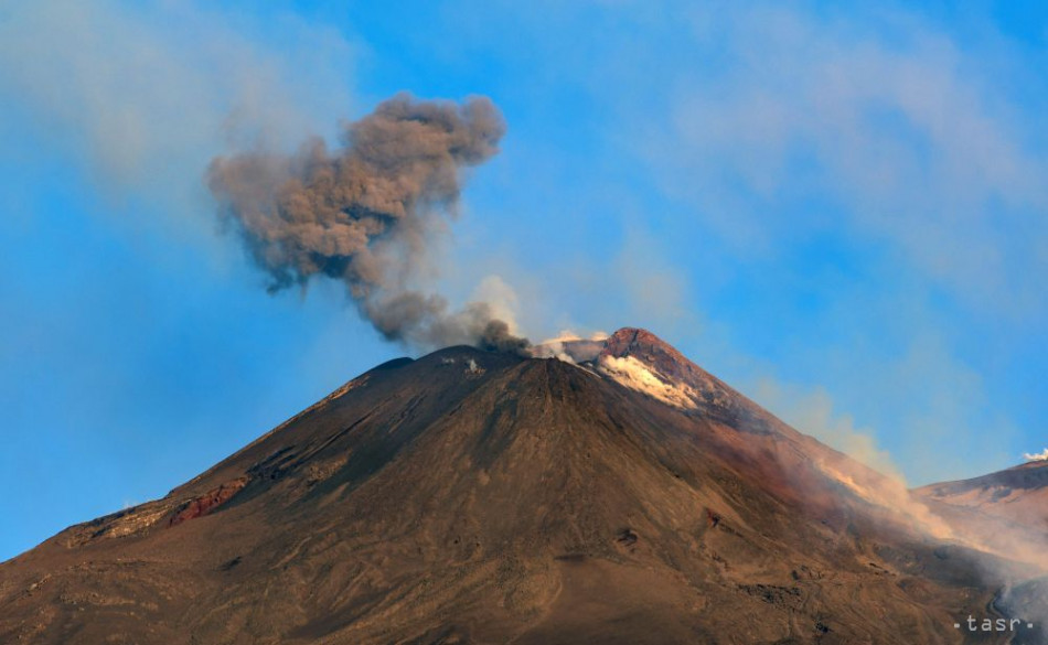
4-a612fe71b1fb856d57f7e60bc22852e09008f4b0.jpg

Etna Volcano
Sicily

The island of Sicily is the greatest in the Inner Sea, and is the most recent addition to the empire. Its major city is Syracuse, Greek in tongue since times immemorial”. Other cities of influence are Messina and Palermo; Sicily is noted for being the place of Punic wars, then he volcano of Etna is described in detail. “On the eastern shore, people speak Greek, in the western parts, you hear villagers speaking a dialect of Latin”[12].

Also noted are the various smaller islands around Sicily, where Malta is said to speak a tongue “similar to that of the Jews, perhaps that of Hannibal”

Calabria

Not much is said about Calabria other than details about the towns; only that almost everyone speaks Greek

Longobardia

“The eastern promontory of Italy is called Longobardia, for much of Italy was settled by Lombards. We should however not mistake this region around Tarent with Greater Lombardy around Mediolanum further north” Tarent is thus the chief city of this region, others mentioned are Brindisi, Otranto and Bari. It is also said that while many speak Greek, also Latin can be heard further north.

Salerno

“Salerno is also one of the most recent additions to the empire, found in southern Campania. The city was a Duchy ruled by Lombards as was neighbouring Benevento for a long time”. Described are the Dukes of Salerno and then the attempts to Hellenize the church, which resulted in the schism

Serbia

“The Diocese of Serbia is found in a mountainous region, to the north and west of Lake Skadar. The Serbs are a Slavic tribe, and used to have kings of their own; traditionally their lands are divided into coastal Zeta and mountainous Rascia”

Dalmatia

Dalmatia is the last Diocese mentioned by Staurakios. It includes: “The coast of Dalmatia, still speaking Latin, but also the inland regions of Croatia and Bosna, which are Slavic”. The northern border of Dalmatia is described to be on the Sava River. In its history chapter, described are the kingdoms of the Croats, and most recently, that many “Hillman adopted the Paulician heresy”


[1] This fictional 12th century geographer is known for writing A Brief Description of the Oecumene, or a short geographic handbook describing the known world.

[2] The word „Latin“ in Rhomaic sources usually refers to Italians, and may be extended also to South Romance speakers and Dalmatians, as well as Occitans. Most likely, they were either Venetians or Genoans and Pisans

[3] Varangians refer to mercenaries, mainly from Scandinavia, Russia and the British Isles; i tis however possible that some Merya or Mordvins were among them as well.

[4] Edirne

[5] Marica

[6] Hudavedingar

[7] Luckily for them, Staurakios did not write that they are Paulicians, but assumed they are Armenian Apostolics.

[8] Black

[9] Referring mostly to Maniot peninsula and Tsakonia in the east

[10] Morava River in Serbia

[11] Aleppo

[12] Reference to the Sicilian language, belonging to the Southern Romance branch

 
Entry: St. Luke's Cape, California
A Beginner's Guide to St. Luke's Cape, California

Welcome all to the sun-drenched city of San Lucas, the pride of California and the Baja Peninsula.

Our city is one steeped in rich history. Originally, the city was referred to as Cabo San Lucas, and part of New Spain. However, this would all be turned on its head in 1841, when American settlers to the region, as well as Natives, became increasingly fed up with Spanish rule. When the American Civil War broke out, they immediately saw Spanish support of the Confederacy, and British support of the Union, as an opportunity. In the year 1847, this part of the country would finally become part of the Union when a joint Anglo-American force invaded Mexico as a way to rout Confederate troops in the Spanish Empire.

When the Spanish surrendered, the Baja Peninsula was part of the new state of California, whose northern half had already split off to become the state of Jefferson. Eventually, Cabo San Lucas was given its Anglicized name, St. Luke's Cape. Ever since then, San Lucas has had an interesting history under the stars and stripes. During the Giant War, it was an important shipyard that oversaw the production of materials bound for the Latin American theater and Peru's war with the Spanish Empire, which had invaded via Gran Columbia.

Unfortunately, St. Luke's Cape would find itself a major part of the fighting in the Americas theater of the Great War. During this time, the state of California was invaded by Spanish troops, which had recently been fresh from the successes in attacking Anglo-American territory in the Caribbean. Luckily, the US Navy, with support from Canadian and Australian allies, helped keep the city from truly capitulating. Today, the memories of this troublesome but ultimately triumphant time can be seen in the ruins of industries strewn across the city.​
 

Grey Wolf

Donor
I'll get something up tomorrow or Friday - I assume I will own the copyright to it and can publish it in my magazine which is due out next week?

Merry Christmas and Best Regards
Grey Wolf
 
Entry: Novoya Amsterdam
Novoya Amsterdam. A tourists guide to the jewel of the Alyskan kingdom.


Dust Jacket Blurb​

While the recently concluded civil war in Alyska has seen an upsurge in tourism to the Kingdom, it is unfortunate that many cities in the kingdom have taken at least some damage in the fighting which saw the United Provinces ultimately reunify Alyska following the breakup of the kingdom in 2000.

Fortunately due to its southern position and being far away from the frontlines of the fighting the city of Novoya Amsterdam survived the war largely unscathed, except for a single bombing in 2006 by the Federal Republic of Alyska.

This book combines detailed maps of the city of Novoya Amsterdam, along with helpful lists of hotels, must visit destinations, restaurants, and much more. Also this book provides dictionary with simple words and phrases in the kingdoms four official languages, Russian, Dutch, Japanese and Stuttlander, to make interactions with locals easier.


Description of the city​

Novoya Amsterdam, like many Alyskan cities, is arranged in four distinct areas. An inner city, expansive wooded park, central city, and outer industrial areas. Many of the buildings date from the massive building works undertaken by the king Francis I in the last quarter of the nineteenth century and are in a uniquely Alyskan style.

The inner city is a mixture of styles. With the ancient Japanese citadel dating from the sixteenth century surrounded by a European style walled city dating from the eighteenth century. Narrow streets and quant buildings typify this part of the city.

The large Herdenkingspark, shaped roughly like a donut, cuts off the old and new cities with large tracts of trees, ponds, walking trails and other areas of interest, on the outer edge of the park is the Geweldige ringweg, which is the cities main processional way. Ringed by statues of famous Alyskans hailing from the city, and the Dutch provinces at large. The park is totally free of admission and has numerous major events, while both military and civil parades are held along the Geweldige Ringweg on important dates.

The central city is the true heart of Novoya Amsterdam, built around a wheel and spoke system of roads, with four main ring roads and eight spoke roads, the central city hosts the bulk of Novoya Amsterdams residential, business, tourist, educational and historic sites.

The city is connected by a well developed metro system with both below, and above, ground lines. A large network of canals has led to the city being dubbed the venice of the new world and water taxis and pleasure craft are common sites along them and easily obtainable for most visitors.

And finally, but perhaps least interesting for the average tourist, is the outer areas of the city. A mixture of industrial areas, vast woodland parks, and suburbs of the city. Trains and roads do connect these areas to the inner city, but visitors to these less interesting areas are much rarer than other parts of Novoya Amsterdam.


History​

Novoya Amsterdam was founded in the middle of the fourteenth century by Japanese fishermen who used the location as a base to operate a large fishing fleet, at the time the site was known as Korimizu and quickly grew in size and importance.

The city became the center of the Japanese colonies in Alyska, known as Umiyoshima after the middle of the fifteenth century it would become the center of the powerful Azuma clan, which lent its name to the surrounding area.

When the Azuma clan founded an independent shogunate in the seventeenth century the Dutch East India company was permitted to build a trading outpost on the island of Kabenoshima, which was permitted to remain when the Tokugawa shogun’s destroyed the Azuma clan. Kabenoshima later became an important arsenal and can still be seen today just off the city.

Umiyoshima would remain an important city afterwards, leading the other Japanese clans in the Tlingit war, during the course of which they attempted to oust the Russian, Dutch and British from the region. Instead Russia purchased the British and Dutch colonies and conquered the region.

Umiyoshima would remain in Japanese hands afterwards, though a significant occupying force would live there until the city was formally added to the Dutch provinces after the end of the second Spanish-Alyskan wars. The city would receive its new name in 1843.

The city would become neglected for much of the next forty years, however a devastating fire in the 1870s would give opportunity for its reconstruction under the future king Francis the first. When rebuilding efforts were completed formally in 1905 Novoya Amsterdam was a shining new city, at the heart of the industrial revolution which was transforming the nation into a great power.

The city became a center for major manufacturing companies, as well as a key naval arsenal where much of the Royal navy was built over the next years. Japan would try to conquer the city in the second world war, however their attempt at taking the city failed in 1943 and their campaign would end in disaster with the epic battle of the Alyskan cape. The largest naval battle in the second world war.

Post was reconstruction saw the city retain its importance and beauty. It would later become the capital of the United Provinces of America, one of several successor states when the old kingdom disintegrated in the aftermath of king Titus’s death.

Today the city is booming and has seen many urban initiatives renovate neglected areas of the city. It is today a fascinating place to visit. Having much more in common with the great capitals of Europe or an Asian city than its counterparts in the United States.


Must see destinations​

Kabenoshima

A small island settled by the Dutch East India company, which established a trading outpost there in the 1660s, it later became a major arsenal and fortification and today is a tourist destination. Admission can be expensive, though worth it, while the island is closed to the public at certain times of the year.

Royal Arsenal

Built in the 1860s the arsenal was, and remains a major production center for the arms used by the Royal Alyskan army, Navy, and airforces. However the site also possesses a number of historic sites which offer tours. Admission is modest, and hours variable.

Novoya Amsterdam Naval base

Attached to the arsenal the naval base in Novoya Amsterdam is a major building, refitting and training center. Also hosting the largest collection of historic ships anywhere in the world, with both naval and merchant vessels displayed. Some key ships to be found are the Athena, Stuttland, Leviathan, Romulus, Dauntless, Ceasar, President. And many others. Admission is free, though hours vary.

Royal Museum complex

A series of museums located in a central courtyard and built in the fashion of an ancient Summarian Ziggurat the museum complex in Novoya Amsterdam is rivalled in the country only by its opposite in Posadka for sheer size and scale. Here visitors can find museums dedicated to art, science, theatre, music, history, warfare, technology, as well as the natural world. Admission is free, though hours vary.

Others

The city host numerous other attractions, such as a myriad of theaters, shops, markets, restaurants, parks, historic sites, roads, and buildings. For a complete guide please visit the cities tourism website as WWW. NovoyaAmsterdamtourism.gov. This website also has an option to arrange your stay, book flights, hire guides and call planned destinations.
 
Cant decide if that is better or worse than the version my computer digested, but I had a great time writing it and reading everyone else's entries.
 
Are we limited to only one post in this?
The main thread doesn't mention a specific rule about number of entries, but I think we should use the same rule as is applied to the map and flag contests, namely that you can make as many entries as you want, but only the last entry will be considered for the poll. That's the rule I'm going to apply for this round, but I'll ask for clarification in the main thread for future rounds.
Sorry if this disappoints.
 
I'll get something up tomorrow or Friday - I assume I will own the copyright to it and can publish it in my magazine which is due out next week?
Merry Christmas and Best Regards
Grey Wolf
To the best of my understanding you always own the copyright to anything you write here (or anywhere else) unless you specifically waive your intellectual property rights.
What I'm not sure about is whether posting something here counts as 'publication' - which can then have an impact on future publications as it's been previously 'published'. I recall seeing something about this in discussions about stories posted in the Writers Forum section of the site, which apparently doesn't count as 'publication' because that's a closed section of the site, i.e. only open to registered members. If this could be a problem, then you should ask for advice from someone more knowledgeable than me.

Merry Christmas also.
 
Entry: Survivor City
Survivor City
A Lifelong Resident's Guide to Darwin
by Natalie Richardson
(1999, Barramundi Press)
Back cover​

With miles of tropical beaches, some of the finest Chinese, Thai and Indian restaurants in the world along Mitchell Street, the only Chinese opera house in the world outside China itself, the spiraling emerald pagoda of the Ho Tower and the spectacular views afforded from its hundredth-floor observation deck, you wouldn't think Darwin would have any trouble attracting tourists… and you'd be half right. Young people flock to the Lightning City from all over Australia, either to experience its nightlife and culture or to find work in the burgeoning tech industry that's raising rents all over the business district.

But I've found most older tourists have the wrong idea of this place. In the case of the oldest of them, their impressions of the city were formed during the late forties and early fifties, when Larrakia was still known by the incredibly dull name of "Northern Territory." They think of it as a giant, crowded refugee camp full of people from China, India and everywhere in between, caught between the old "White Australia" policy, the tyranny of the Greater East Asian Co-Prosperity Sphere and the occasional tropical storm. They think of it as a place administrated by the U.S. Navy and the Red Cross or not at all, with a tiny population of white Australians huddled in their old neighborhoods, waiting for everybody else to go away again.

I was one of those "original" Darwinians. I have vivid memories of my parents warning me not to have anything to do with the teeming hordes in the apocalyptic wasteland outside lest I be addicted, kidnapped or possibly eaten… and then hiring people from those same hordes to cook and clean and look after me. Those people often had children of their own, in whose company I snuck out to explore the "wasteland" every chance I got. Looking back, I can see that it really was a dreadful place, but I was a child getting my first impression of what a city was supposed to look like. Having grown up with that and seen what Darwin has become, forgive me if I'm a bit of a booster.

Less venerable tourists first learned about Darwin from the 1973 blockbuster Cyclone City. These people think of it as a city full of ethnic gangs, crime and intrigue, where everybody's either smuggling heroin into Australia or trying to fund the liberation of their homeland from the Japanese. (And — though they try not to say so out loud — they think of it as a place where even the architecture looks foreign and the few white people not in naval uniform stick out like sore thumbs.) I have to say heroin was and is still a major business in Darwin, although the city has always been more of a transshipment point than a market — even a city of over three million can't use that much. And yes, a lot of the money from that illicit business did go into weapons and communications for the various liberation movements throughout East Asia. But you know what? The Co-Prosperity Sphere has been gone for fifteen years as of this writing. You're welcome, world.

But let's talk about the present day. Yes, there's still a naval base in the middle of the waterfront, and almost everyone in the city would very much like it to stay there. For a lot of people, that's part of the appeal. Here are beaches where your children can see an aircraft carrier come into port, or where a young lady can flirt with actual Navy SEALs (or possibly actual Navy supply officers claiming to be SEALs — bit of a calculated risk).

Yes, the architecture of modern Darwin is a blend of traditional Chinese and Indian styles, and it owes very little to the dreary or unsettling forms that have taken over the cities of Europe and America since the Soviet War. This is just how we like it.

Yes, one or two tourists have suffered misfortune in the tiger and rhino preserves. Here's a hint. These places are refuges for wild animals. If you remember this and stay on your side of the fence, you can appreciate the hard-work that many Chinese-Australians have put into saving these magnificent species from extinction at the hands of the Chinese traditional medicine market. If you treat these places as petting zoos, don't expect any sympathy. Not in a city that is literally named after Charles Darwin.

And yes, with the rise of the tech industry and the "discovery" of my hometown by young tourists, the best restaurants and hotels are getting a little expensive. Not to worry. There are still plenty of places where you can get a good meal and a comfortable room on a budget, and some of the most interesting things to see and do won't set you back at all…
 
Top