The NextGen worlda has a 2017 map posted - it will be updated in a few weeks once I release all the 3.0 maps (which are on an updated base map, and have a lot of fixes, not that the 2017 one needed that many). The Q-BAM and M-BAM maps certainly have them as well. As Redcoat said, the Wiki is also your friend.Could we have links to present-day versions of each map please? I'm having zero luck with the search function, but surely present-day maps (or something approaching present-day maps) must exist!
You are using an out of date browser. It may not display this or other websites correctly.
You should upgrade or use an alternative browser.
You should upgrade or use an alternative browser.
Base Map & Resource Index
- Thread starter hadaril
- Start date
So I found this thread and wanted to add some stuff.
1- As for now there have been a lot of patches and fixes on Q-BAM, so I made a map which includes them all. Also the link to the Q-BAM thread takes you to the historical patches thread, you should fix that.
2- I also made my own colour scheme like a year or so ago, this was a personal project, but if somebody wants to use it I won't oppose.
I've noticed on the maps that show the borders of the Russian Empire don't show the border between the Turgai and Akmolinsk oblasts. Could someone with better map-making skills than me fix that, please?
This is nothing whatsoever to do with a TL that I am totally not in the process of writing.
This is nothing whatsoever to do with a TL that I am totally not in the process of writing.
Acenos
Banned
The Base Map & Resource Index
----------------------------------------------------------------------------------------------------------------
AlternateHistory.com has produced some simply amazing resources over the past ten years, however, the vast amount of base-maps, color schemes, and other resources has made it difficult to find the most current threads and indexes of them.
This post (and subsequent updates of it) will serve as an index of these projects. I will attempt edit this post to keep this thread as up to date as possible. If new projects emerge, leave a reply, and I'll update with a link to the most current thread of it! Without further ado, here's the list.
I will try to keep the Wiki updated as well, but you should always assume that these forum threads will be more up to date than the Wiki, despite our best efforts.
This thread isn't for mass-posting OTL map images; The place for that is either on it's own thread, or on the "OTL Basemap thread".
--------------------------------------------------------------------------------------------------------------------
Base Maps (from smallest to largest)
--------------------------------------------------------------------------------------------------------------------
Color Schemes (from smallest to largest)
- Revised Color Scheme
- Next-Gen Color Scheme (fork of RCS)
- TACOS
- X2 Color Scheme
- Drex's Color Scheme (DCS)
- TOAST3R (3.0)
- SUCK
-------------------------------------------------------------------------------------------------------------
As always, credit for these maps go to their respective owners and creators.
Where can i find mercator and miller Worlda maps?
As far as I'm aware, there aren't any.Where can i find mercator and miller Worlda maps?
Acenos
Banned
i seriously need mercator and miller basemaps right now.As far as I'm aware, there aren't any.
and especially since that request i made for a steven universe base map involves doing it in mercator
The Universal Religious Colour Scheme:

Should include all scenarios, with exception of maybe North American mythologies, which are too numerous too be pointed out individually...
Should include all scenarios, with exception of maybe North American mythologies, which are too numerous too be pointed out individually...
Acenos
Banned
The Base Map & Resource Index
----------------------------------------------------------------------------------------------------------------
AlternateHistory.com has produced some simply amazing resources over the past ten years, however, the vast amount of base-maps, color schemes, and other resources has made it difficult to find the most current threads and indexes of them.
This post (and subsequent updates of it) will serve as an index of these projects. I will attempt edit this post to keep this thread as up to date as possible. If new projects emerge, leave a reply, and I'll update with a link to the most current thread of it! Without further ado, here's the list.
I will try to keep the Wiki updated as well, but you should always assume that these forum threads will be more up to date than the Wiki, despite our best efforts.
This thread isn't for mass-posting OTL map images; The place for that is either on it's own thread, or on the "OTL Basemap thread".
--------------------------------------------------------------------------------------------------------------------
Base Maps (from smallest to largest)
--------------------------------------------------------------------------------------------------------------------
Color Schemes (from smallest to largest)
- Revised Color Scheme
- Next-Gen Color Scheme (fork of RCS)
- TACOS
- X2 Color Scheme
- Drex's Color Scheme (DCS)
- TOAST3R (3.0)
- SUCK
-------------------------------------------------------------------------------------------------------------
As always, credit for these maps go to their respective owners and creators.
Well yes they do.
Check the wiki
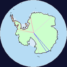
Can someone here make an arctic centered Worlda basemap?

Make two versions of the map. one at this scale:

And another at this scale:
Why do people spend so much time working on administrative subdivision?
What are people using these maps for? In timelines they almost universally are used to show changing international borders, very rarely have I seen many timelines go into deep detail about administrative divisions and the organisation of townships. That would require an absurd level of detail for alternate history.
Most of the majors maps, apart from WorldA are filled with people posting threads where they minutely go through the tiniest of subdivisions of their country. This seems next to useless for a world map. The only time people need that level of detail is when they're talking about that country in particular, and then they'll just use that.
On top of this internal admin divisions change all the time and quickly go out of date even when international borders don't change. Most uses of these admin divisions would presumably be well used by the many already existing maps produced by the governments of countries of their own internal divisions. Or those on Wikipedia.
And yet, so many man hours are put into these amazingly crafted maps and no one has even completed a 2019 map of countries, never mind a 1945 or 1939 map. You know, maps that people would want to use for wargames or a timeline.
I can understand people working on the coast, people working on the details of rivers, islands, or on topography. All of these are useful on a global world map. International borders, disputed areas and rebellions. I can understand all of that. But what's the use of administrative divisions? As you get more smaller and smaller they get more and more useless. What are people using these maps for? Am I an idiot? I feel like I must be missing something obvious because the whole map threads are filled with admin divisions and yet I never see them used.
Whereas I always see maps of 1939 or 1945 or whatever, modified for whatever alternate history scenario it is.
I see websites like omniatlas and where is this here? Surely people are interested in a consistently mapped timeline of the world, with campaigns, international changes, etc. Not admin levels where consistency is irrelevant since you only ever care about one country.
Edit: Also another reason you might not even want admin levels on your map. If you're showing a map of your timeline and you use a map from here, you might be confident about the international situation but the internal situation of every country? The exact path every country followed that led to their current internal borders? No one knows that, so people have to waste time erasing all that hard work. Which makes me wonder why people don't post layered maps like svgs more often here. Pngs are fine for final products but even a blank updated map posted here should have a:land layer, a coast layer, and a border layer.
Administrative subdivision is a convenient reference lines for drawing AH borders even if they do not match with OTL subdivisionsWhy do people spend so much time working on administrative subdivision?
Administrative subdivision is a convenient reference lines for drawing AH borders even if they do not match with OTL subdivisions
You mean people use the subdivisions to change international borders? I suppose I can see the value in that
yesYou mean people use the subdivisions to change international borders?
https://azgaar.github.io/Fantasy-Map-Generator/
I'm posting a link to this excellent resource here, seems like the right place. It will get lost in the middle of the map thread. If there is a better place to post it on this forum just PM me and I'll post it there.
I'm posting a link to this excellent resource here, seems like the right place. It will get lost in the middle of the map thread. If there is a better place to post it on this forum just PM me and I'll post it there.
It's pretty good but I recommend settings the number of points above 60k because otherwise the coasts look pretty bland.https://azgaar.github.io/Fantasy-Map-Generator/
I'm posting a link to this excellent resource here, seems like the right place. It will get lost in the middle of the map thread. If there is a better place to post it on this forum just PM me and I'll post it there.
Share: